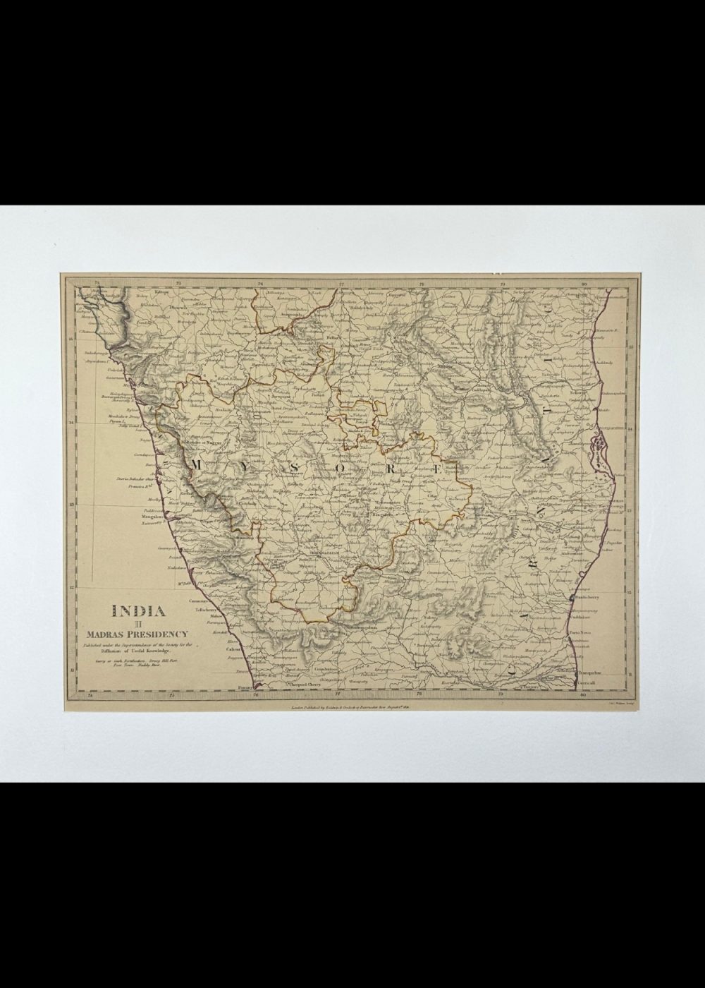
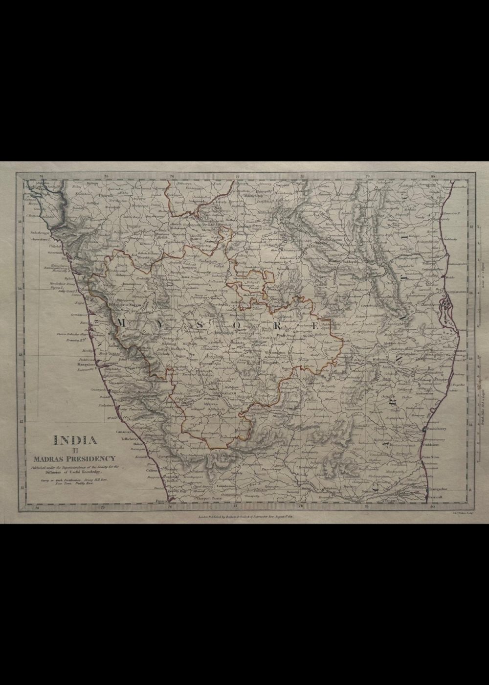
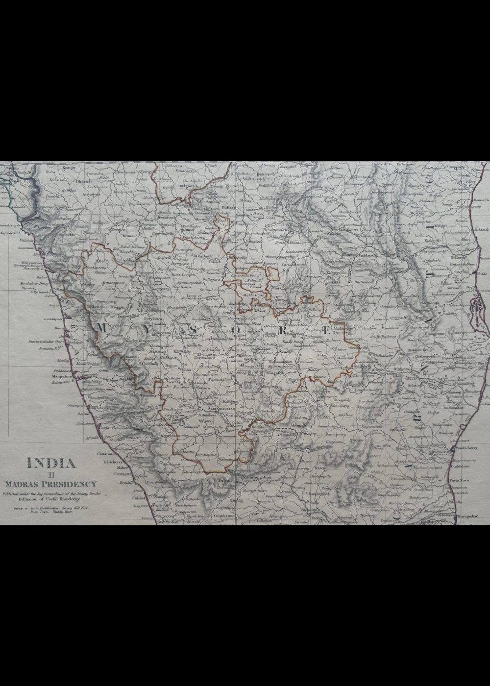
INDIA II MADRAS PRESIDENCY
Product Details:
Artist or Maker: UNKNOWN
Map Mounting Size (inches): 13.98 (L) x 17.13 (W) / (cm): 35.5 (L) x 43.5 (W)
Map Image Size (inches): 10.04 (L) x 13.58 (W) / (cm): 25.5 (L) x 34.5 (W)
Please Note:
All prices are inclusive of taxes.
All orders are fully insured during transit for added protection.
This item is not eligible for shipping outside of India.
₹24,999.00
In stock
Description
Returns / Shipping
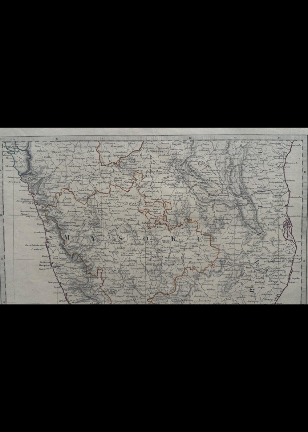
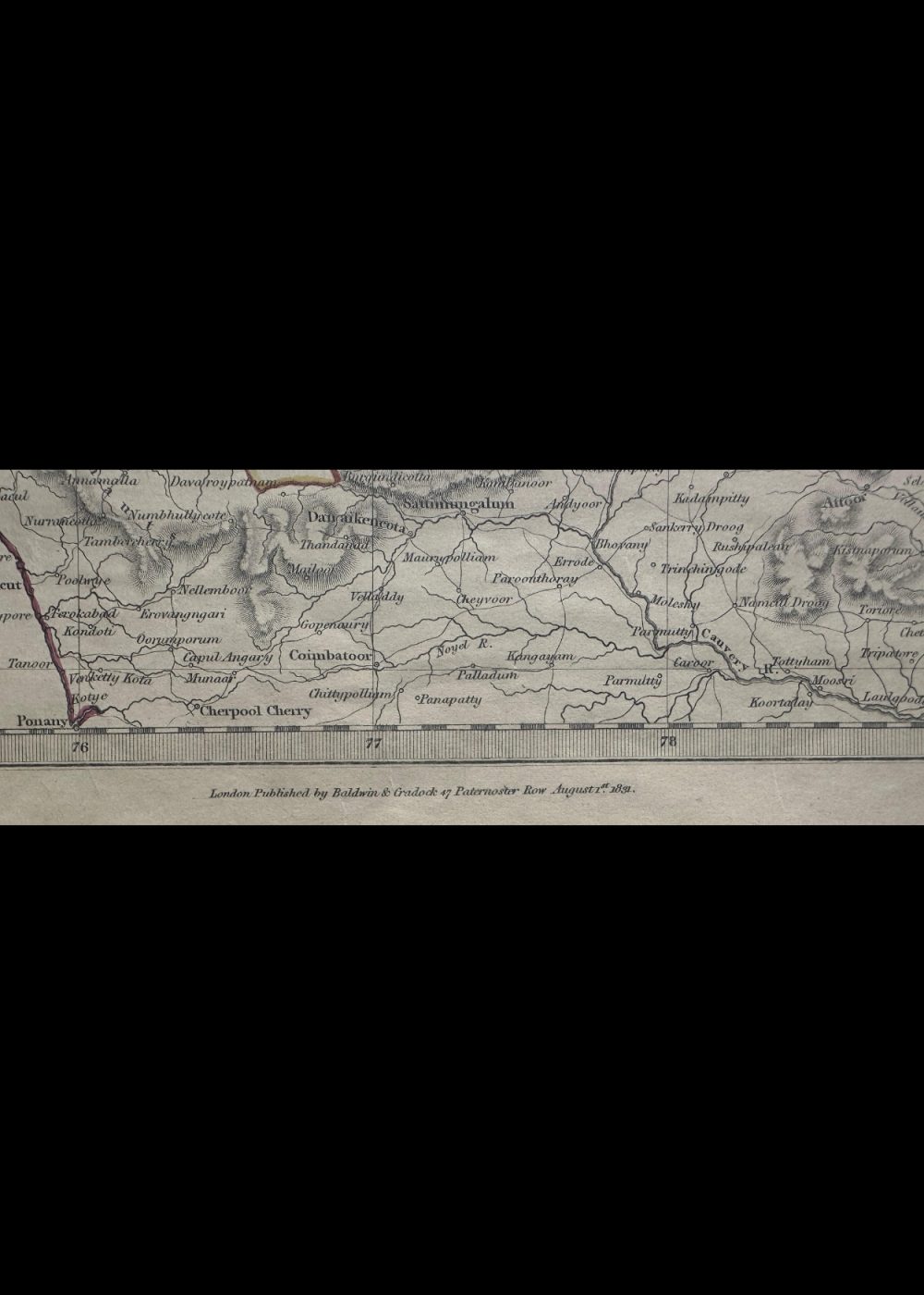
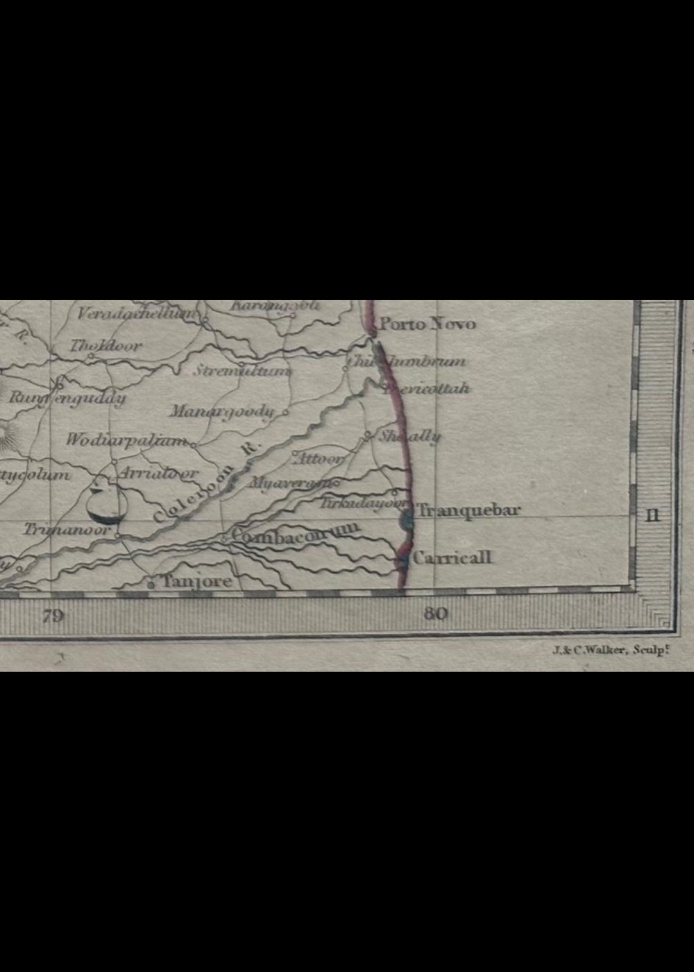
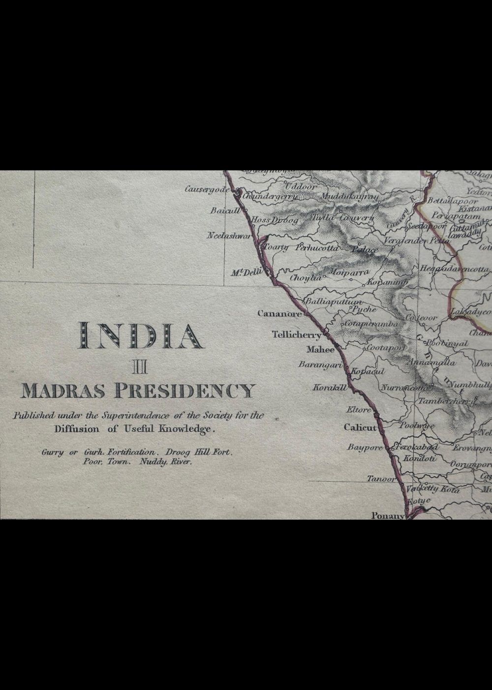
This is a historical map titled “India II – Madras Presidency”, published in the 19th century by the Society for the Diffusion of Useful Knowledge. It depicts the Madras Presidency, a major administrative region under British colonial rule, covering much of present-day Tamil Nadu, parts of Andhra Pradesh, Kerala, and Karnataka. The map includes detailed representations of towns, rivers, mountain ranges, and territorial boundaries, offering a rich visual record of southern India’s geography and colonial administration during that era.
Product Details
| Artist or Maker | UNKNOWN |
| Map Mounting Size | (inches): 13.98 (L) x 17.13 (W) / (cm): 35.5 (L) x 43.5 (W) |
| Map Image Size | (inches): 10.04 (L) x 13.58 (W) / (cm): 25.5 (L) x 34.5 (W) |
Returns / Shipping
Returns
We accept returns within 7 days of delivery, provided the item is received in a damaged condition.
Shipping
- Shipping charges are additional and will be calculated based on the delivery address.
- All orders are fully insured during transit for added protection.
- Please note: This item is not eligible for international shipping and can be delivered within India only.