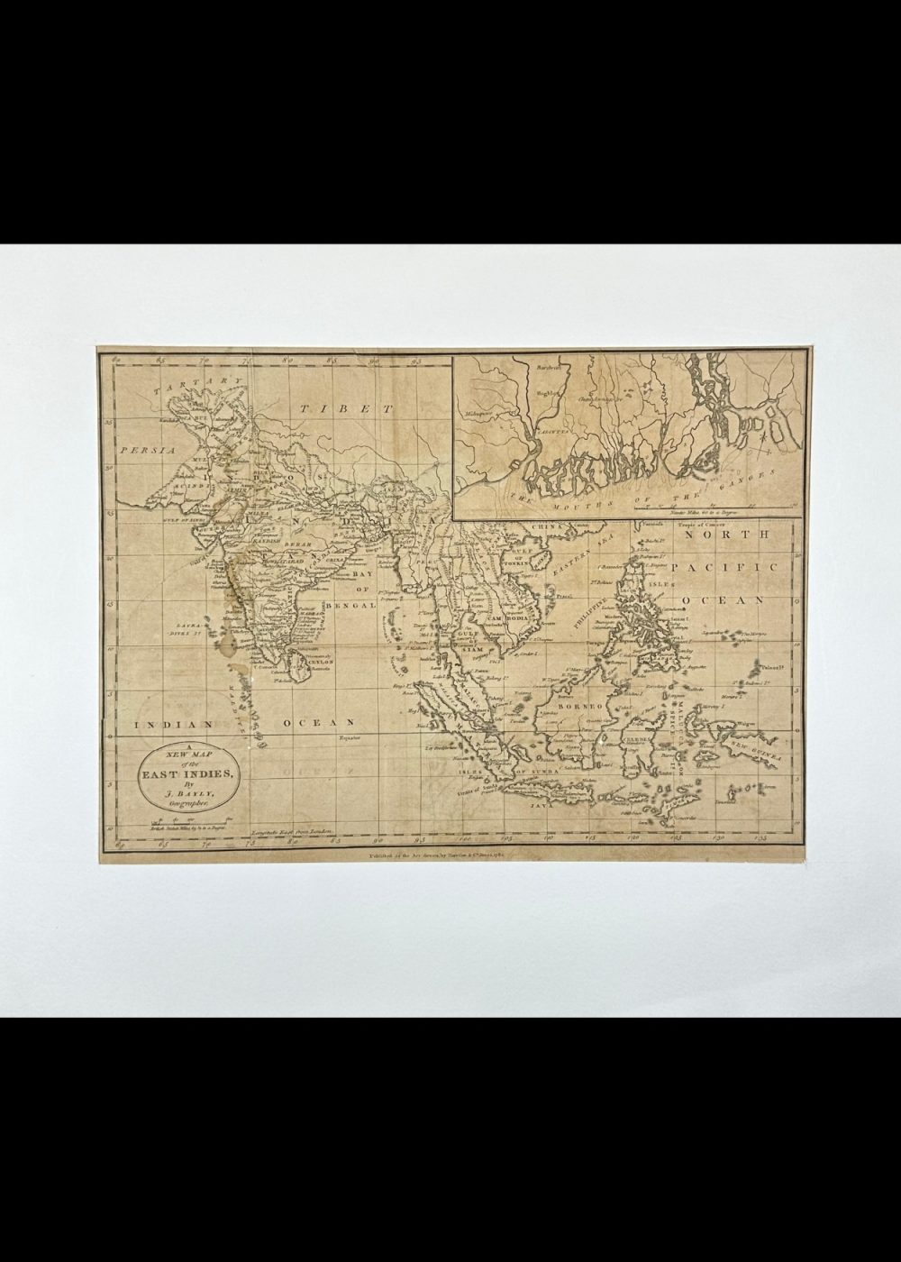
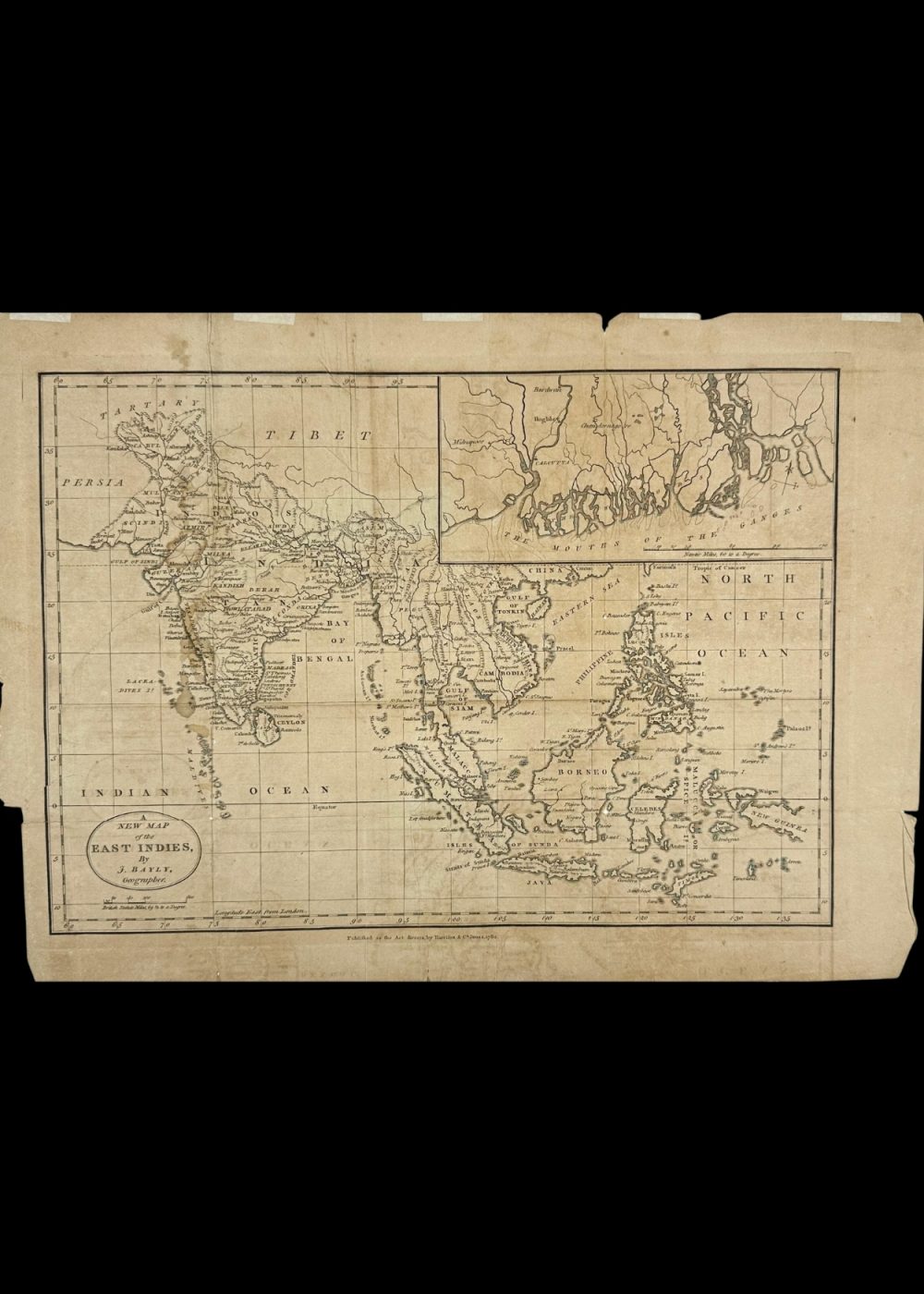
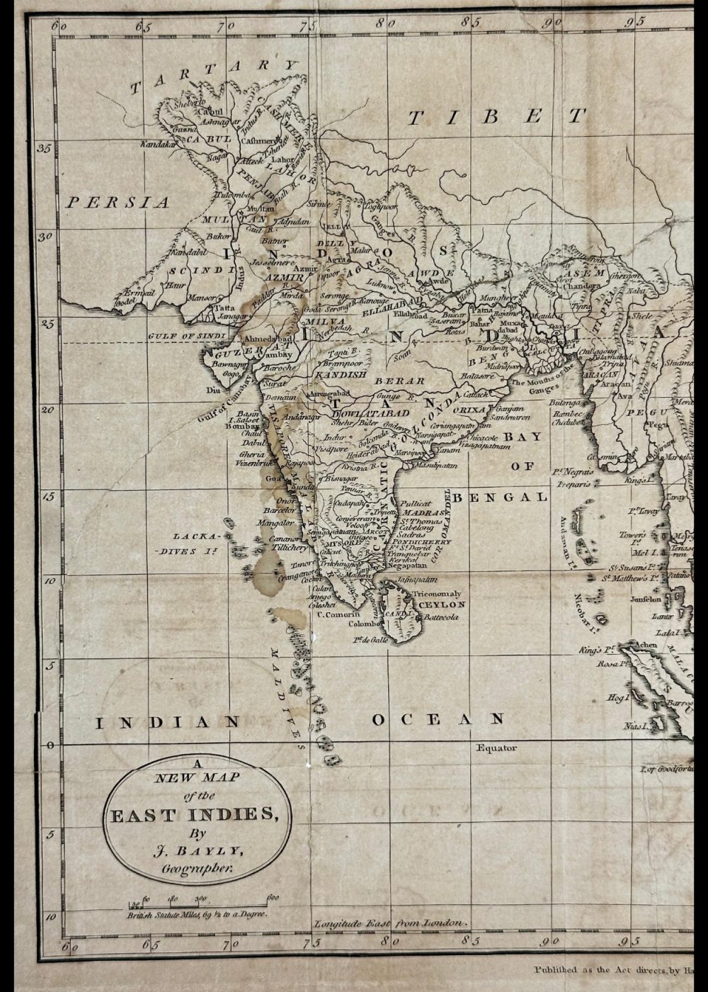
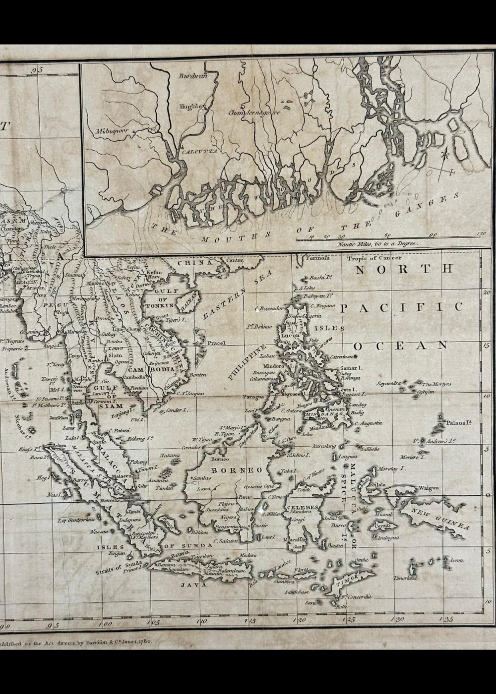
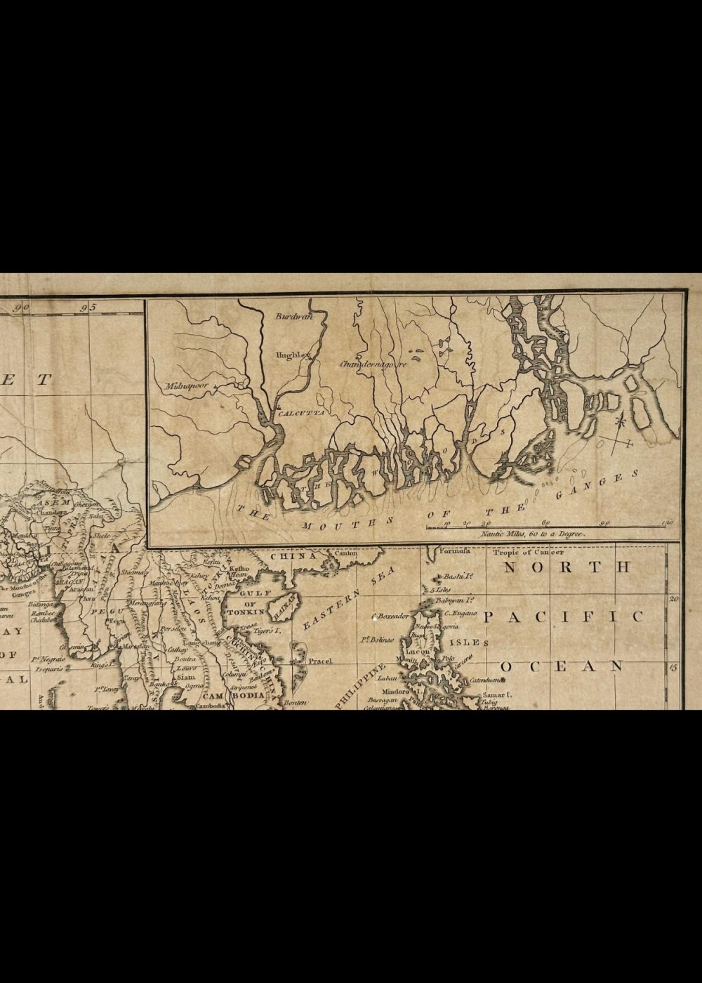
A NEW MAP OF THE EAST INDIES
Product Details:
Artist or Maker: UNKNOWN
Map Mounting Size (inches): 14.02 (L) x 16.54 (W) / (cm): 35.6 (L) x 42 (W)
Map Image Size (inches): 12.6 (L) x 8.82 (W) / (cm): 32 (L) x 22.5 (W)
Please Note:
All prices are inclusive of taxes.
All orders are fully insured during transit for added protection.
This item is not eligible for shipping outside of India.
In stock
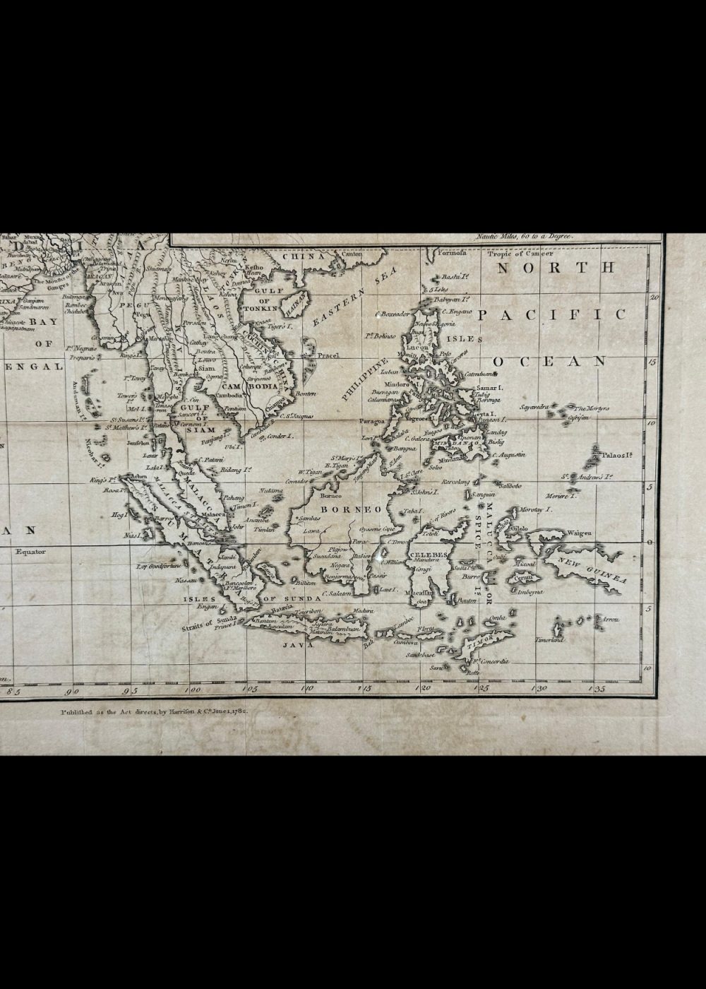
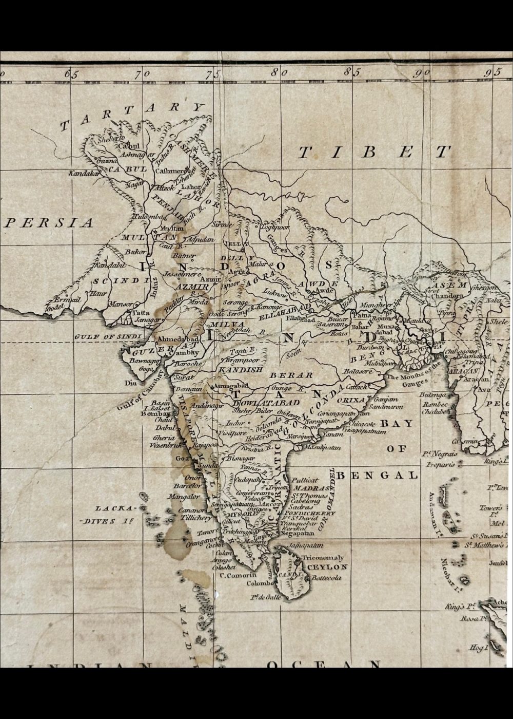
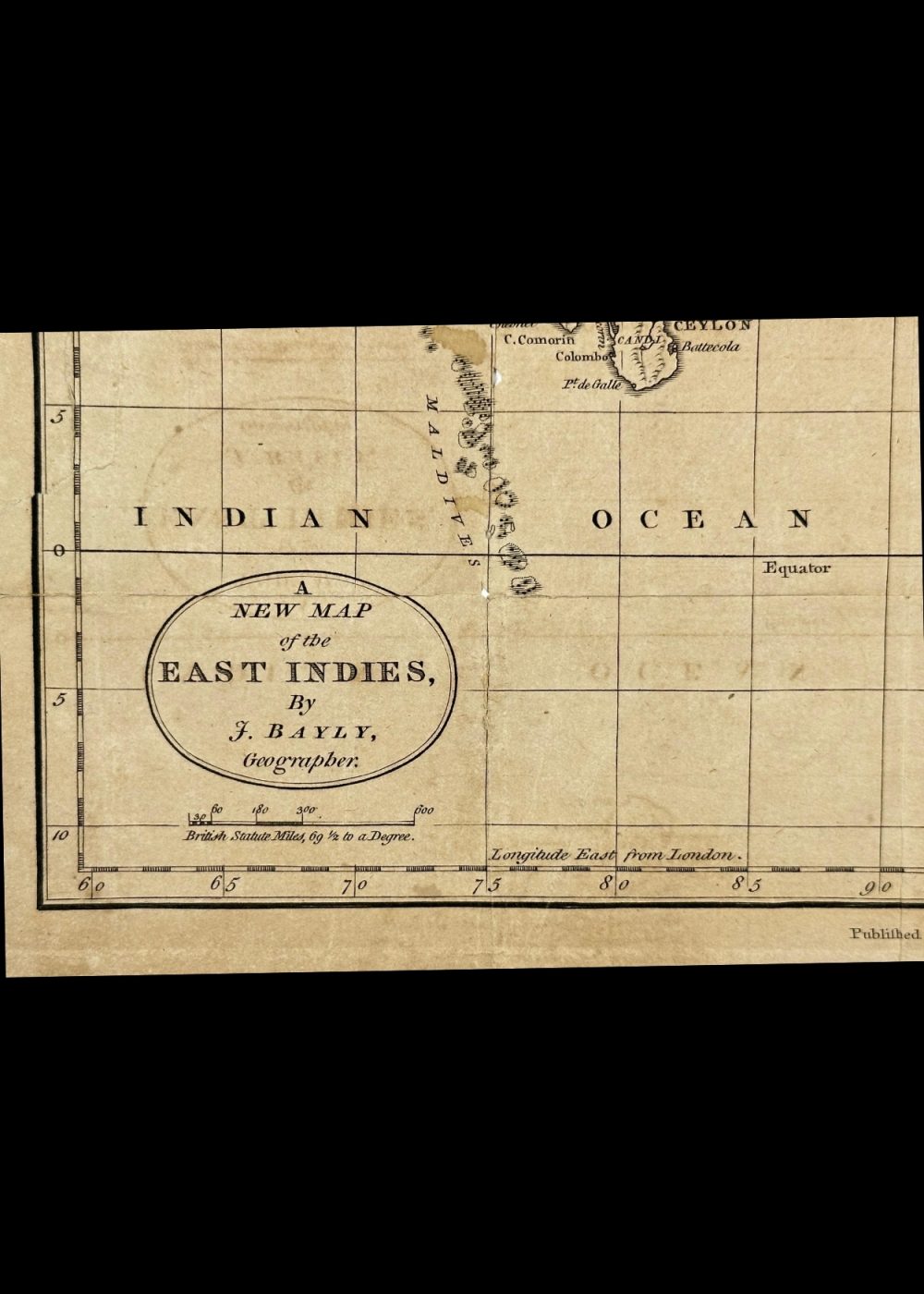
This historical map titled “A New Map of the East Indies” was created by geographer J. Bayly and published in 1794. It captures the rich geography of South and Southeast Asia, including regions such as India, Persia, Tibet, China, Siam, the Malay Peninsula, and the Indonesian archipelago. Notable features include detailed coastlines, major trade routes, and an inset map of the Ganges Delta near Calcutta. This elegant antique map reflects colonial-era exploration and trade dynamics, making it a valuable artifact for collectors and historians alike.
Product Details
| Artist or Maker | UNKNOWN |
| Map Mounting Size | (inches): 14.02 (L) x 16.54 (W) / (cm): 35.6 (L) x 42 (W) |
| Map Image Size | (inches): 12.6 (L) x 8.82 (W) / (cm): 32 (L) x 22.5 (W) |
Returns / Shipping
Returns
We accept returns within 7 days of delivery, provided the item is received in a damaged condition.
Shipping
- Shipping charges are additional and will be calculated based on the delivery address.
- All orders are fully insured during transit for added protection.
- Please note: This item is not eligible for international shipping and can be delivered within India only.