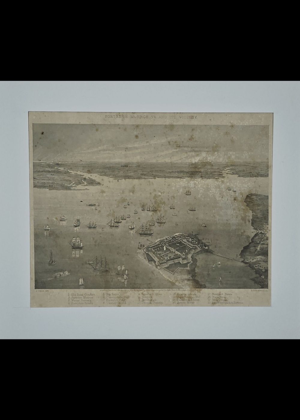
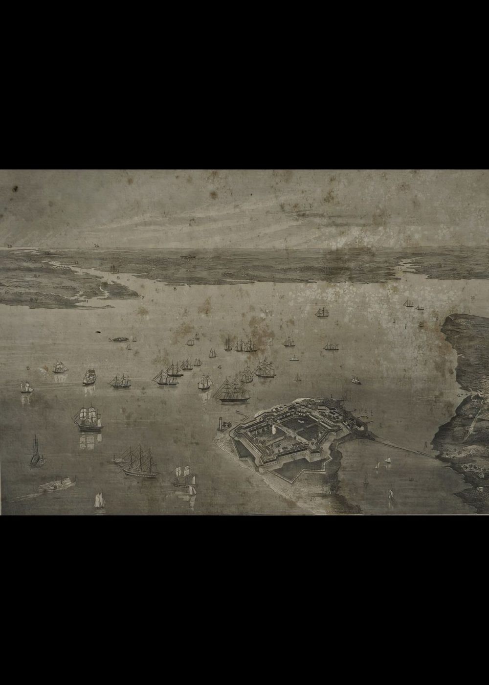
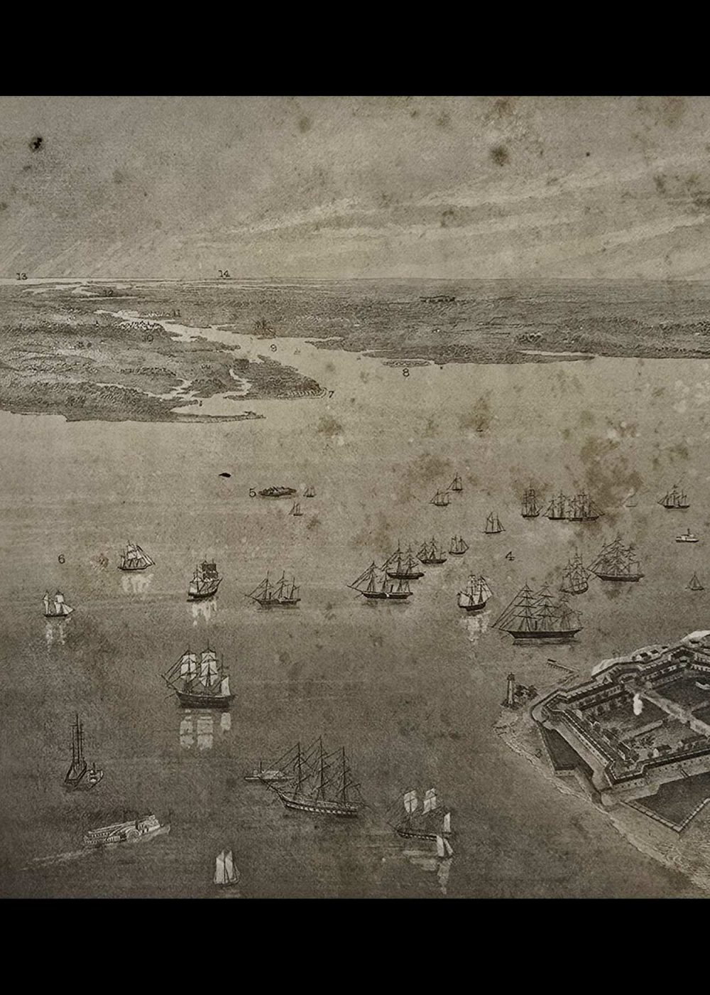
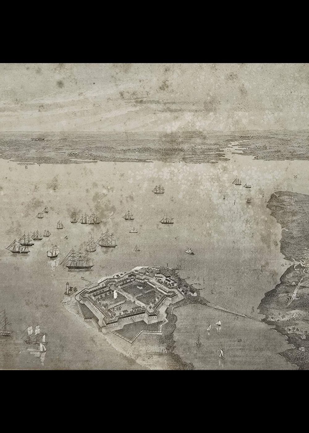
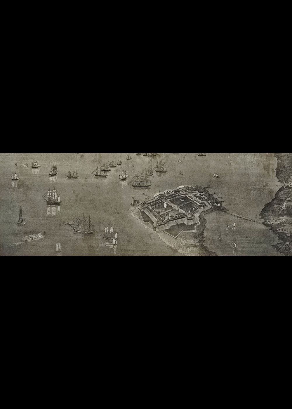
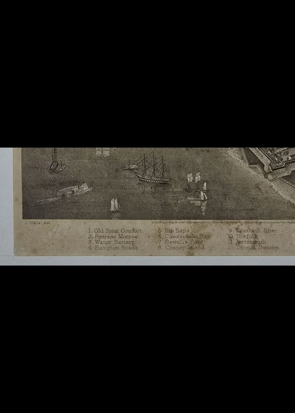
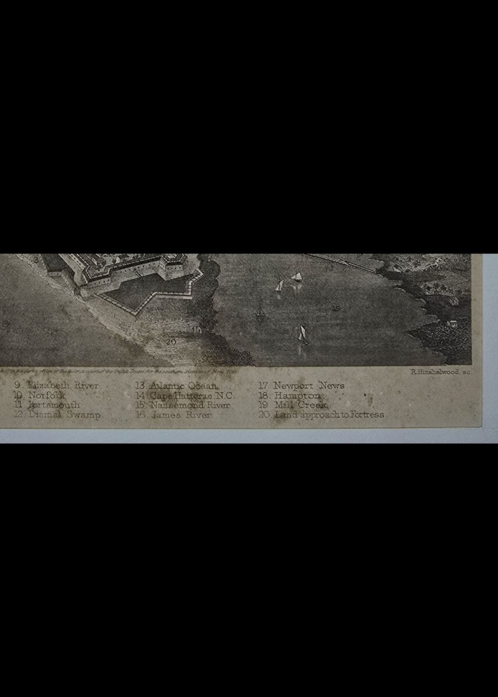


FORTESS MONROE, VA AND ITS VICINITY
Product Details:
Artist or Maker: J. Wells, del
Engraver: R. Hinshelwood, sc
Engraving Mounting Size (inches): 11.02 (L) x 12 (W) / (cm): 28 (L) x 30.5 (W)
Engraving Image Size (inches): 6.25 (L) x 11.25 (W) / (cm): 15.9 (L) x 28.6 (W)
Please Note:
All prices are inclusive of taxes.
All orders are fully insured during transit for added protection.
This item is not eligible for shipping outside of India.
₹12,999.00
In stock
Description
Returns / Shipping
This is a historical illustration titled “Fortress Monroe, VA and Its Vicinity,” depicting the strategic coastal fortification at the mouth of the Chesapeake Bay during the 19th century. The detailed engraving shows Fort Monroe prominently in the foreground, surrounded by numerous sailing and steam-powered ships in Hampton Roads, a key naval anchorage. The map includes labeled landmarks such as Old Point Comfort, Sewall’s Point, Chesapeake Bay, and James River, emphasizing the area’s military and maritime significance, especially during the Civil War era. The surrounding geography and waterways are intricately rendered, highlighting the fort’s crucial defensive position along the Atlantic coast.
Product Details
| Artist or Maker | J. Wells, del |
| Engraver | R. Hinshelwood, sc |
| Engraving Mounting Size | (inches): 11.02 (L) x 12 (W) / (cm): 28 (L) x 30.5 (W) |
| Engraving Image Size | (inches): 6.25 (L) x 11.25 (W) / (cm): 15.9 (L) x 28.6 (W) |
Returns / Shipping
Returns
We accept returns within 7 days of delivery, provided the item is received in a damaged condition.
Shipping
- Shipping charges are additional and will be calculated based on the delivery address.
- All orders are fully insured during transit for added protection.
- Please note: This item is not eligible for international shipping and can be delivered within India only.