INDIA VII
Product Details:
Artist or Maker: UNKNOWN
Map Mounting Size (inches): 13.98 (L) x 17.83 (W) / (cm): 35.5 (L) x 45.3 (W)
Map Image Size (inches): 9.88 (L) x 14.13 (W) / (cm): 25.1 (L) x 35.9 (W)
Please Note:
All prices are inclusive of taxes.
All orders are fully insured during transit for added protection.
This item is not eligible for shipping outside of India.
₹24,999.00
In stock
Description
Returns / Shipping
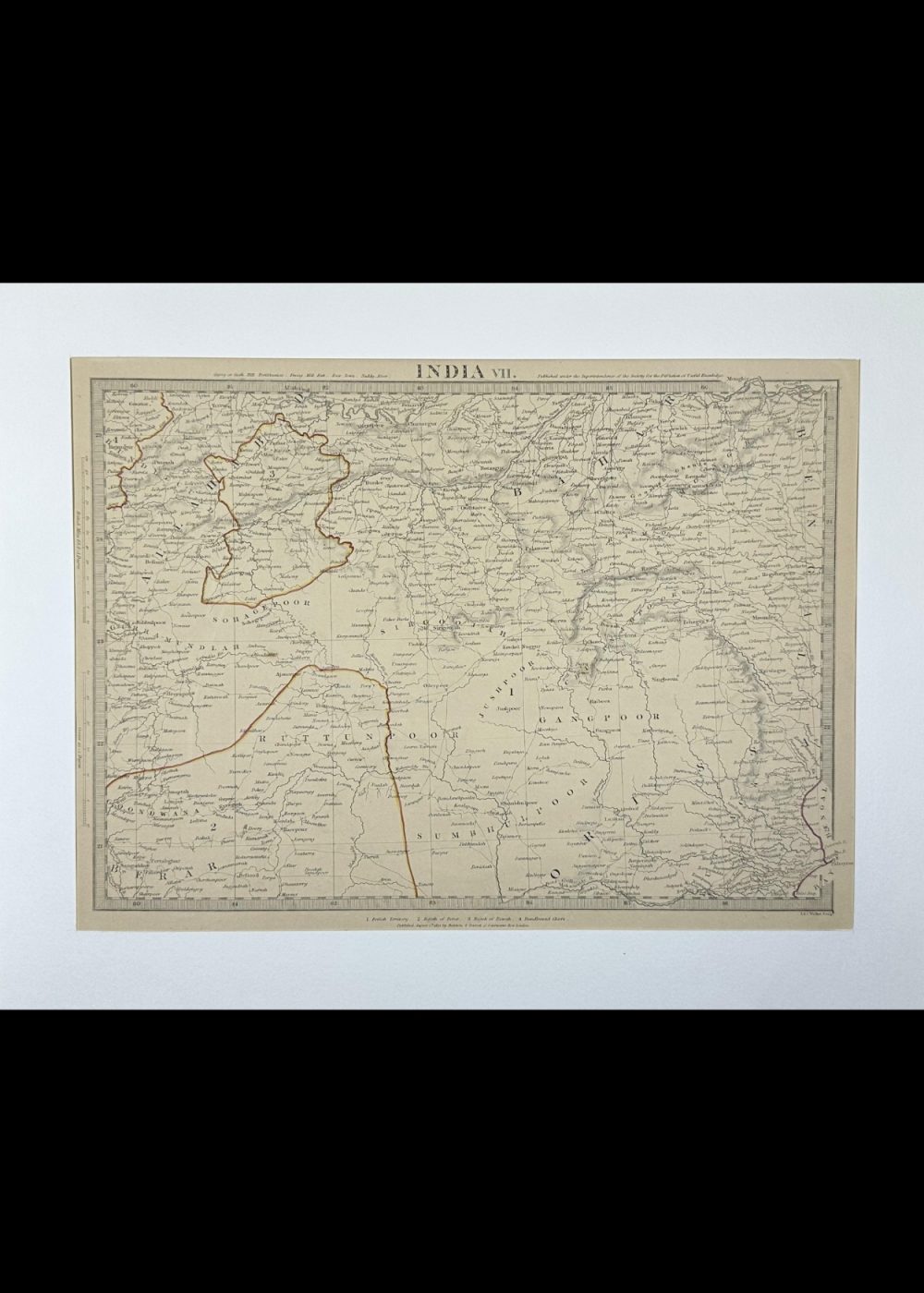
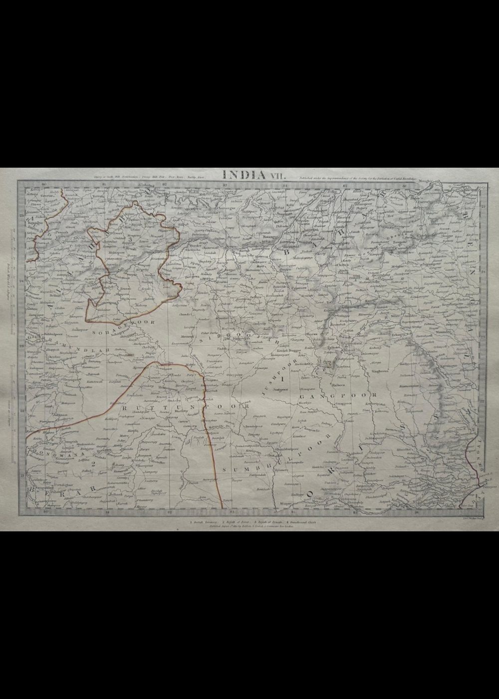
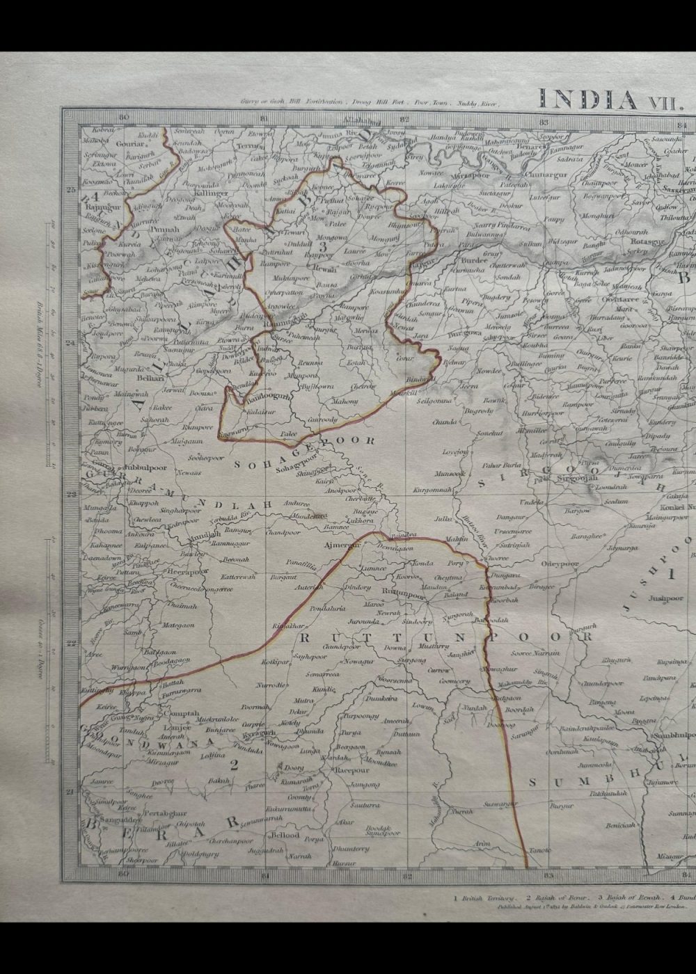
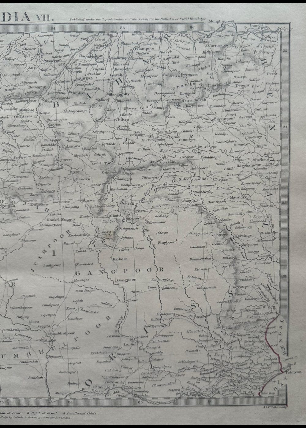
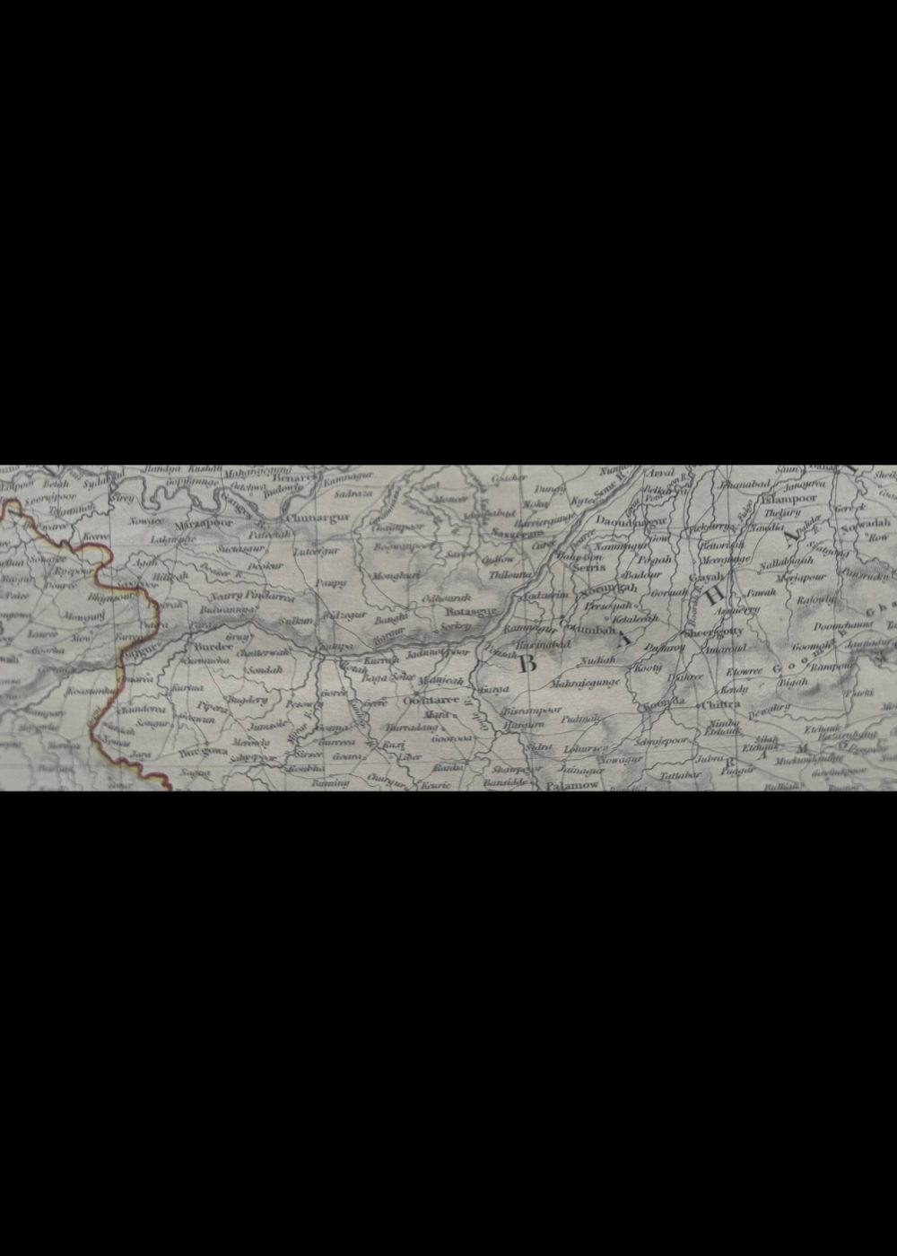
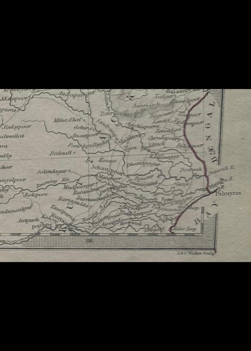
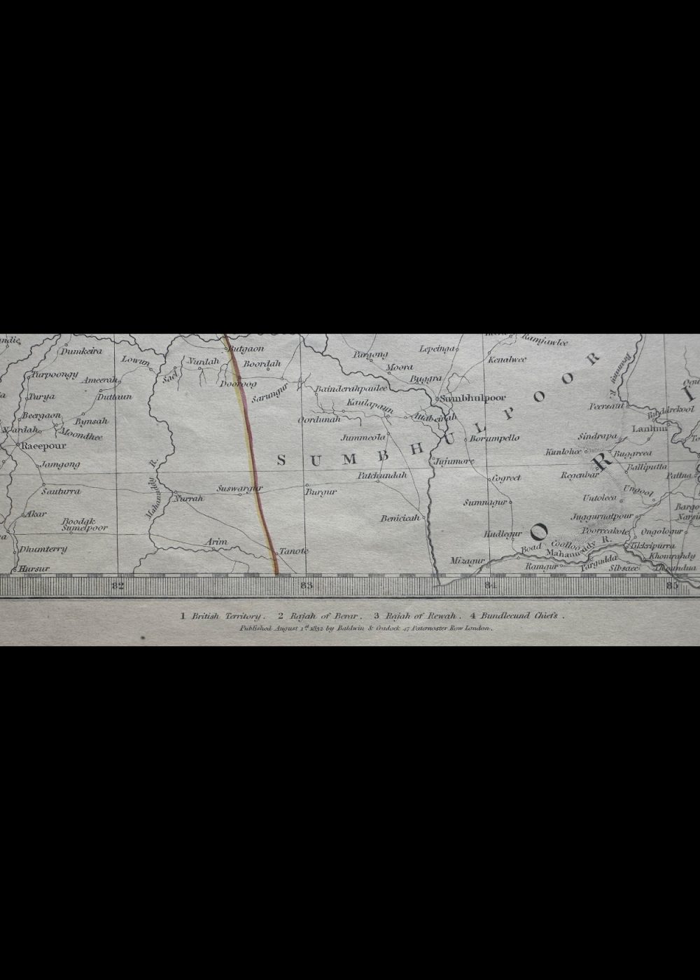
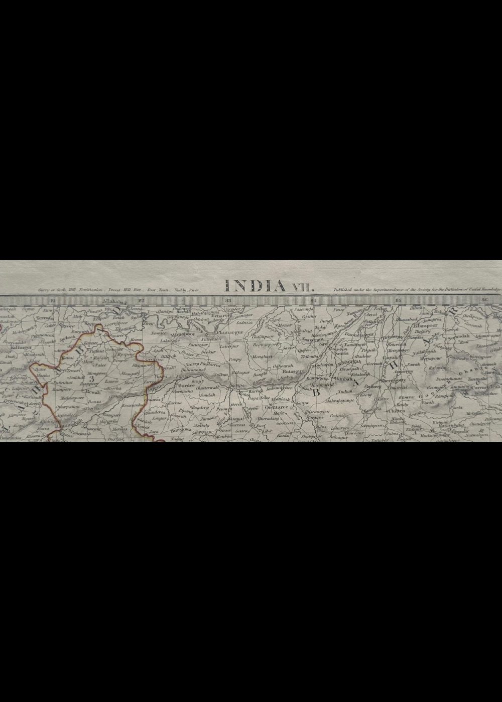
This is a historical map titled “INDIA VII,” published under the auspices of the Society for the Diffusion of Useful Knowledge. It delineates various regions of central and eastern India with color-coded territorial boundaries. Notably, the legend identifies zones governed by entities like the British Territory, Rajah of Berar, Rajah of Nagpoor, and Bundelcund Chiefs. The map includes extensive labeling of towns, rivers, and other key geographical features, offering insight into India’s administrative and political divisions during the 19th century British colonial period.
Product Details
| Artist or Maker | UNKNOWN |
| Map Mounting Size | (inches): 13.98 (L) x 17.83 (W) / (cm): 35.5 (L) x 45.3 (W) |
| Map Image Size | (inches): 9.88 (L) x 14.13 (W) / (cm): 25.1 (L) x 35.9 (W) |
Returns / Shipping
Returns
We accept returns within 7 days of delivery, provided the item is received in a damaged condition.
Shipping
- Shipping charges are additional and will be calculated based on the delivery address.
- All orders are fully insured during transit for added protection.
- Please note: This item is not eligible for international shipping and can be delivered within India only.