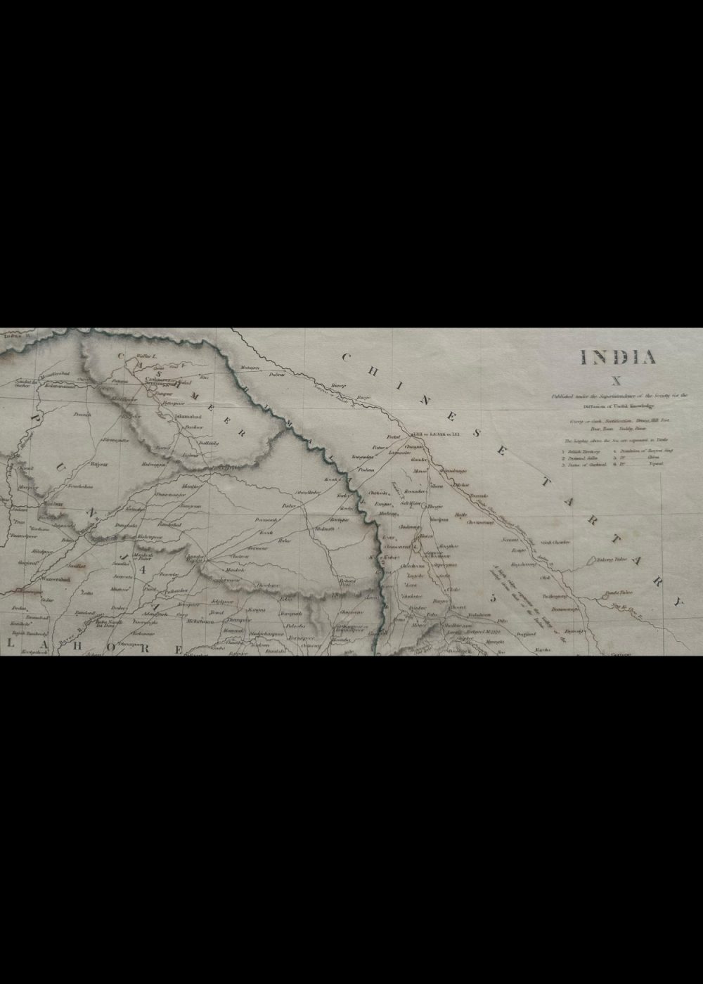
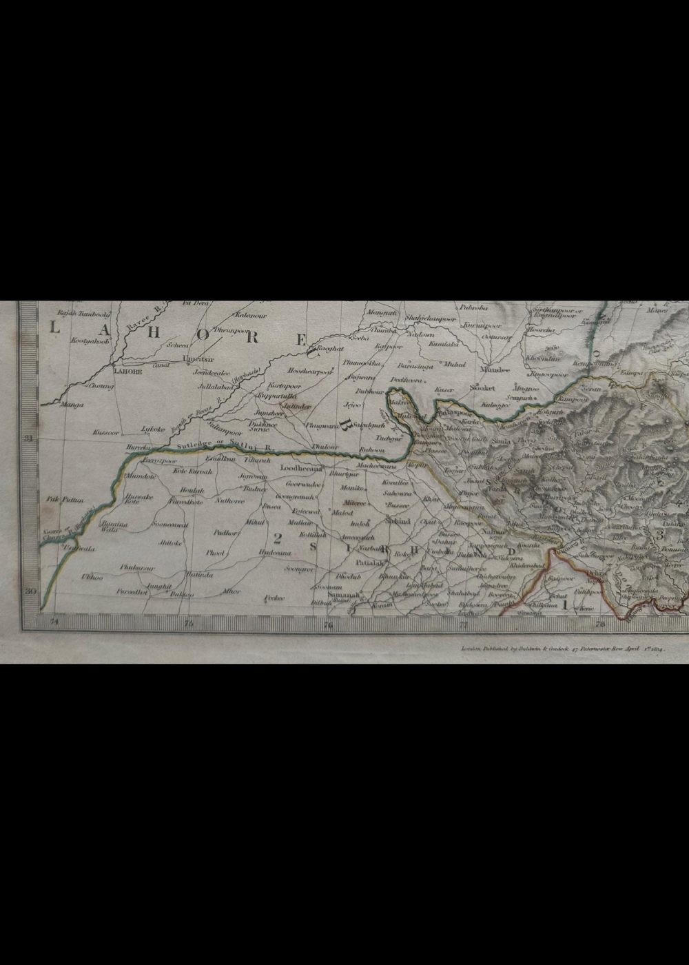
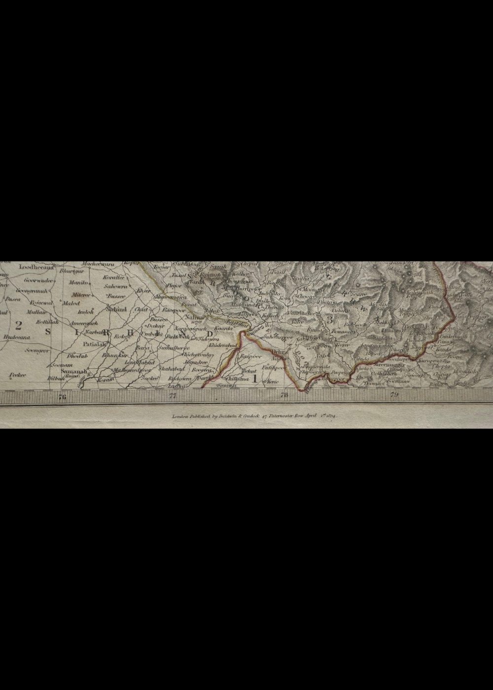
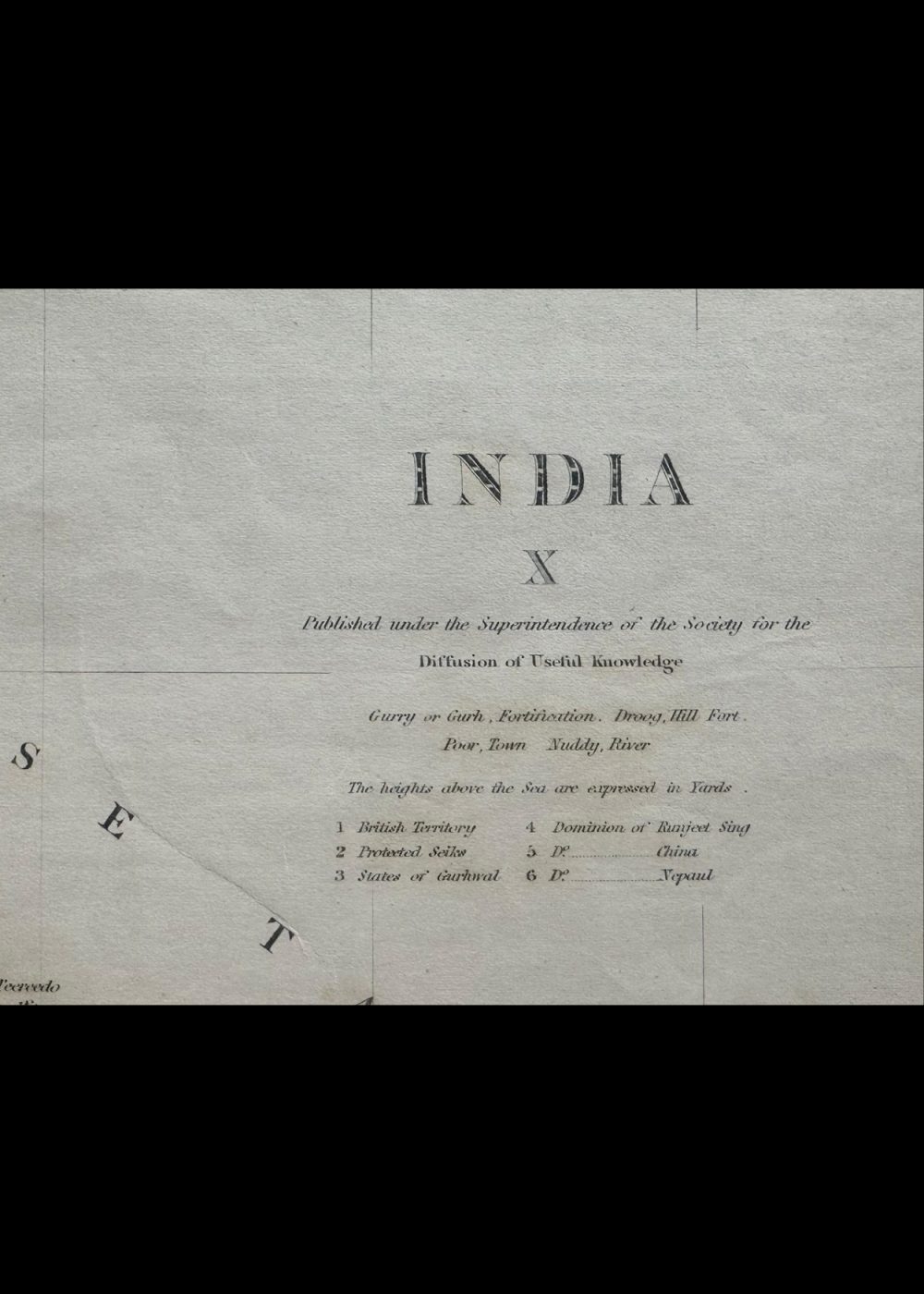
INDIA X
Product Details:
Artist or Maker: UNKNOWN
Map Mounting Size (inches): 13.98 (L) x 17.87 (W) / (cm): 35.5 (L) x 45.4 (W)
Map Image Size (inches): 10.39 (L) x 13.82 (W) / (cm): 26.4 (L) x 35.1 (W)
Please Note:
All prices are inclusive of taxes.
All orders are fully insured during transit for added protection.
This item is not eligible for shipping outside of India.
In stock
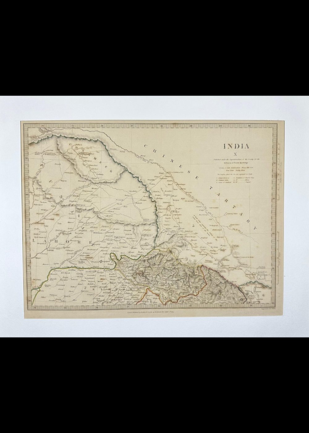
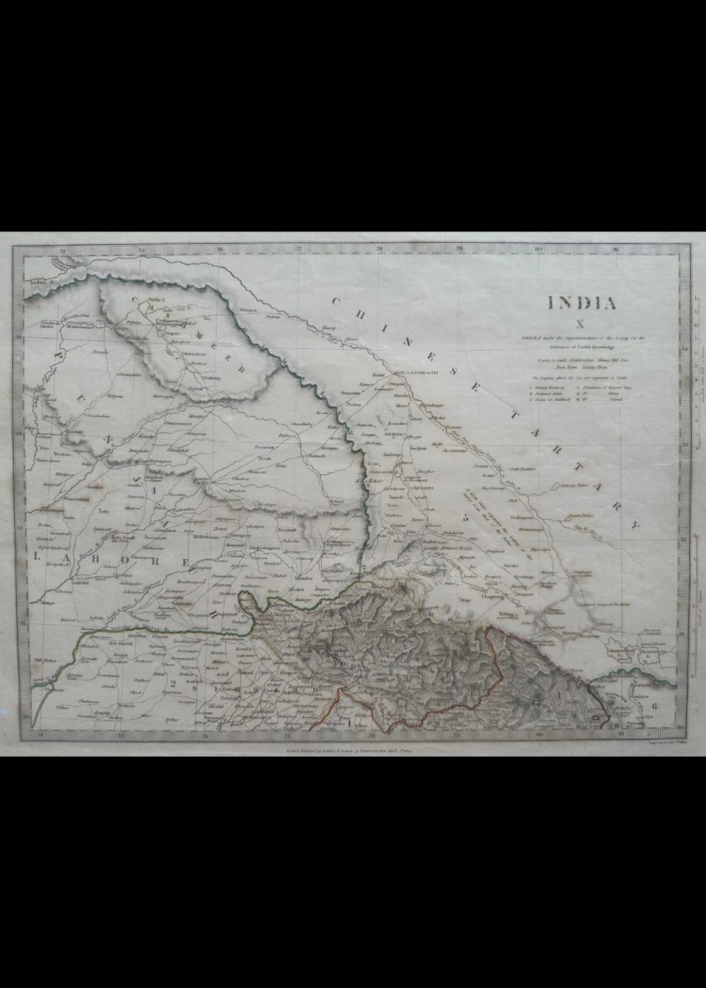
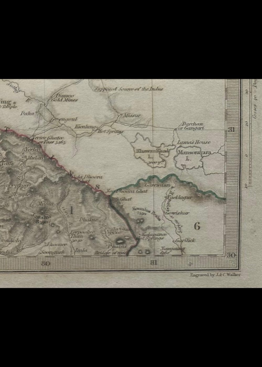
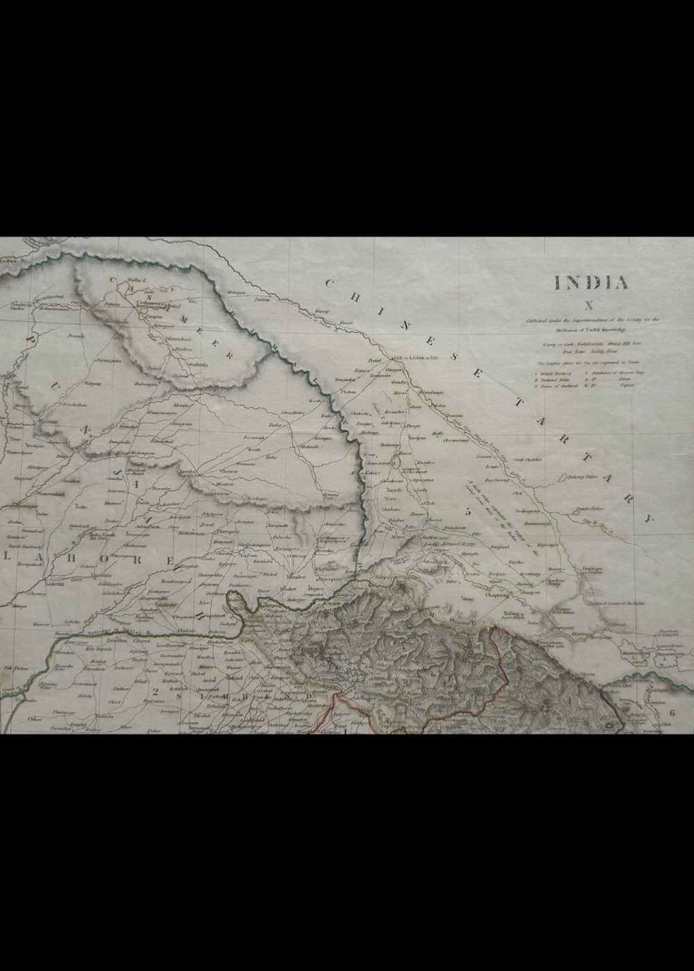
This is a historical map titled “INDIA X”, created under the superintendence of the Society for the Diffusion of Useful Knowledge. It offers a detailed 19th-century cartographic representation of northern India, extending into regions of modern-day Pakistan, Afghanistan, and Chinese Tartary. The map showcases major cities such as Delhi, Lahore, and Kabul, alongside rivers, mountain ranges, and trade routes. A detailed legend categorizes towns into over 80 classes based on significance, and elevations are marked in Toises (an old French unit of length). The map is not only a geographical record but also a reflection of colonial-era administrative and scholarly efforts to document South Asia with precision.
Product Details
| Artist or Maker | UNKNOWN |
| Map Mounting Size | (inches): 13.98 (L) x 17.87 (W) / (cm): 35.5 (L) x 45.4 (W) |
| Map Image Size | (inches): 10.39 (L) x 13.82 (W) / (cm): 26.4 (L) x 35.1 (W) |
Returns / Shipping
Returns
We accept returns within 7 days of delivery, provided the item is received in a damaged condition.
Shipping
- Shipping charges are additional and will be calculated based on the delivery address.
- All orders are fully insured during transit for added protection.
- Please note: This item is not eligible for international shipping and can be delivered within India only.