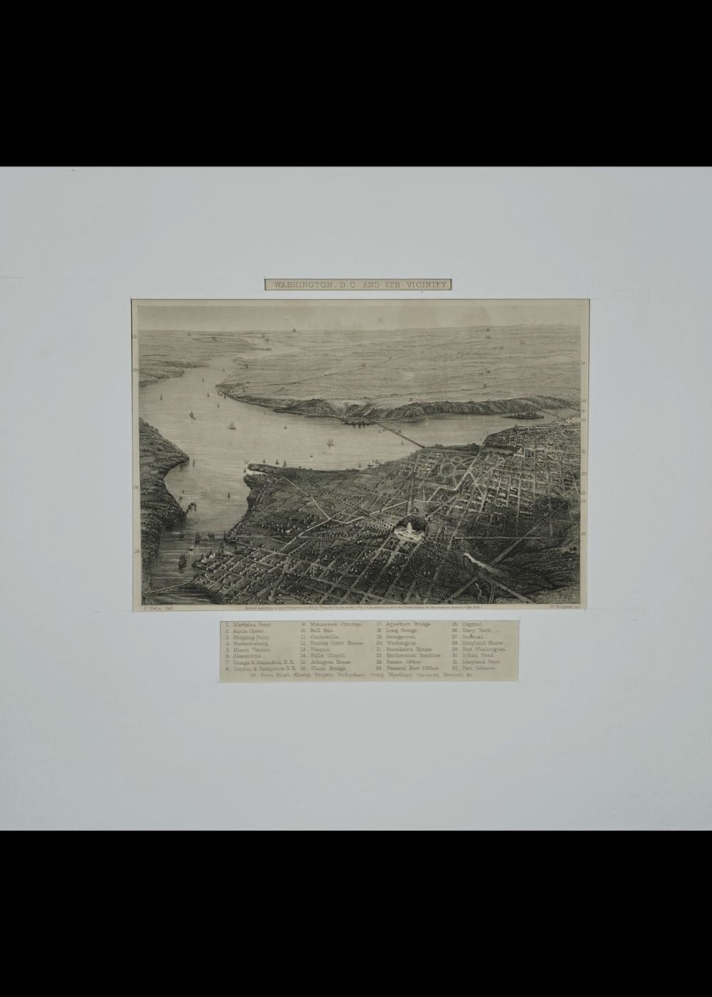
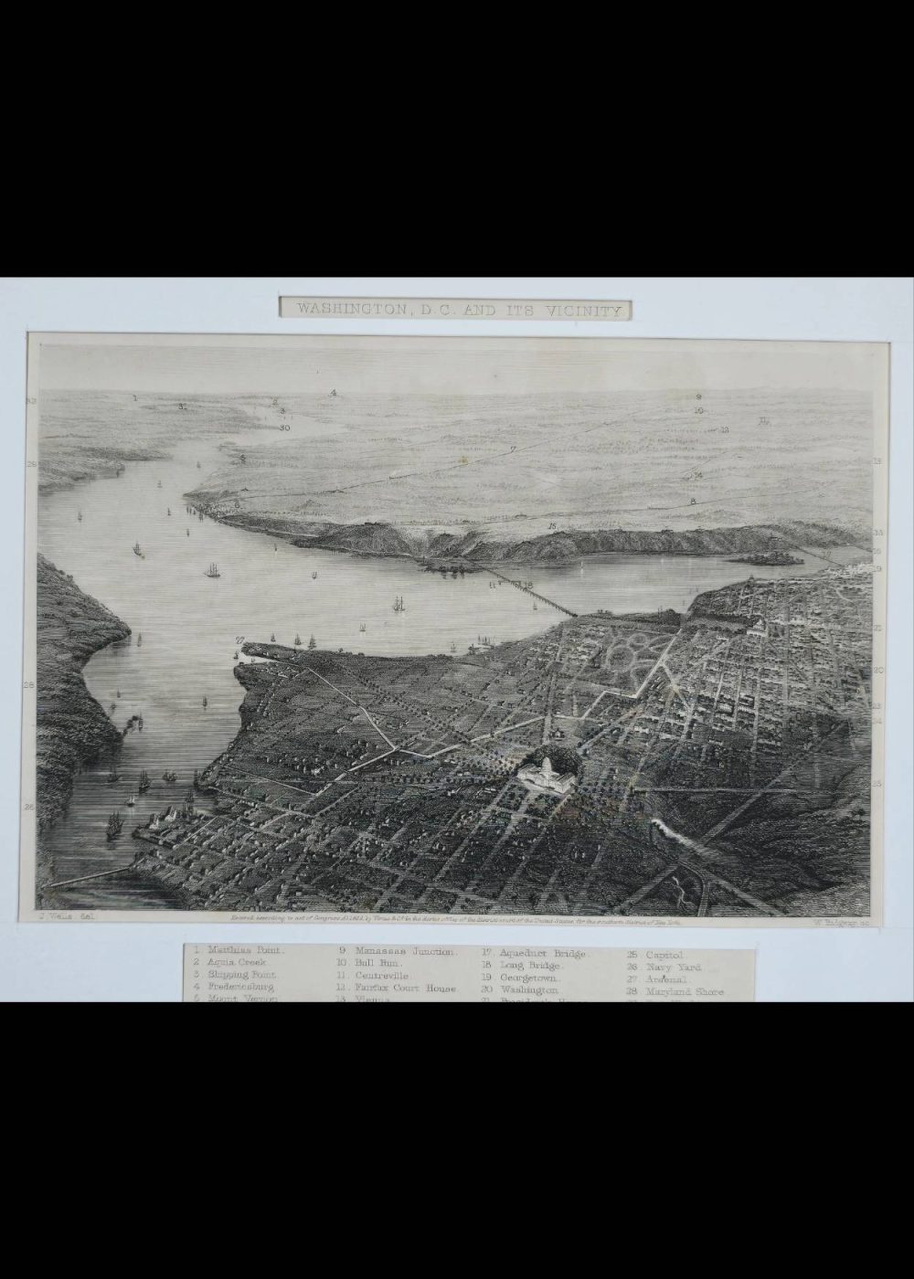
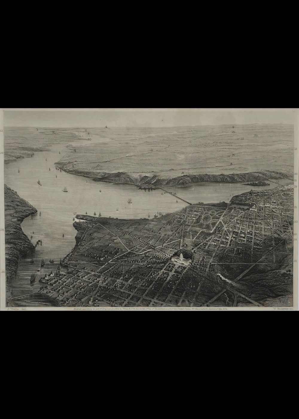
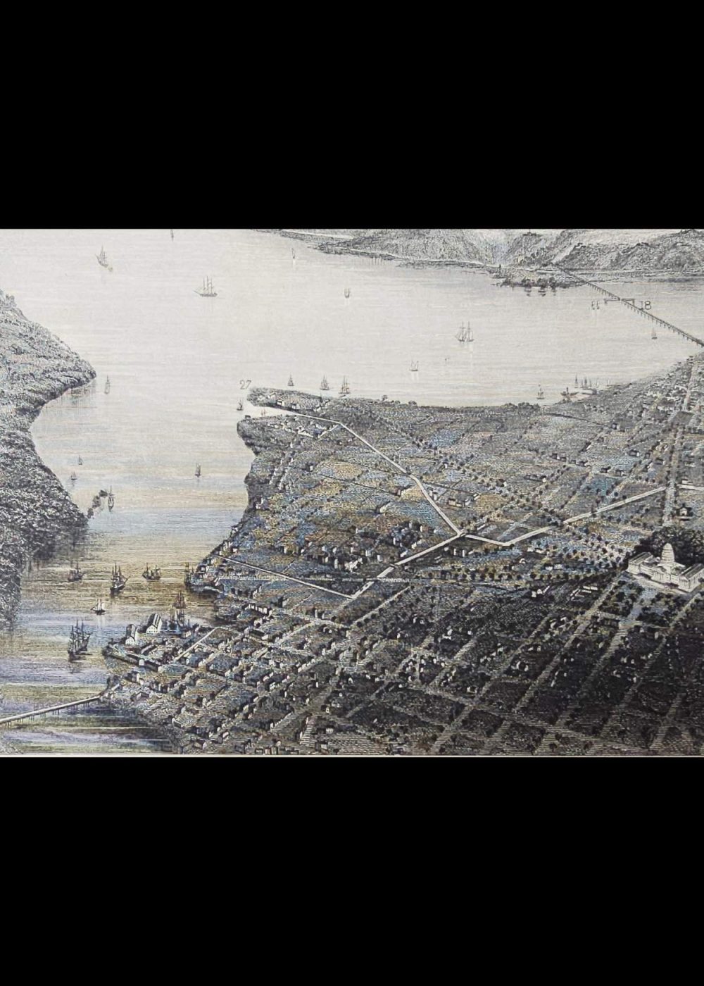
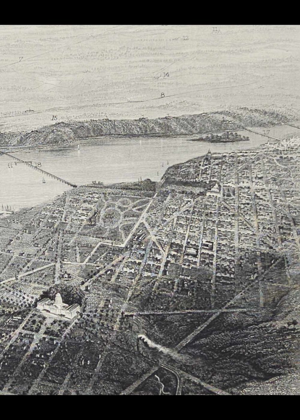
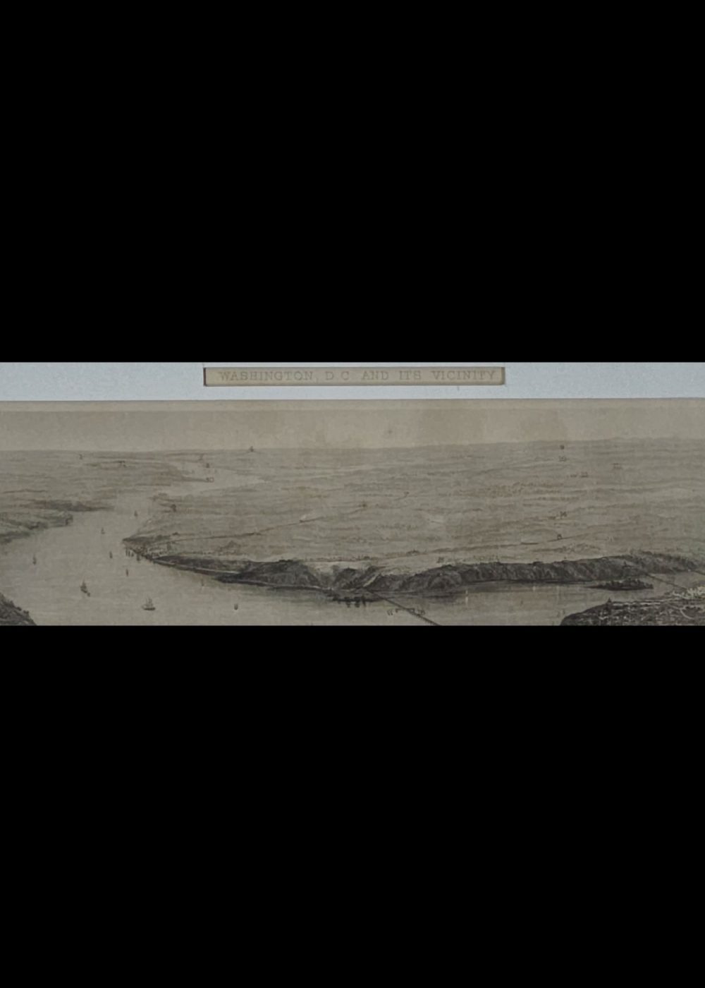
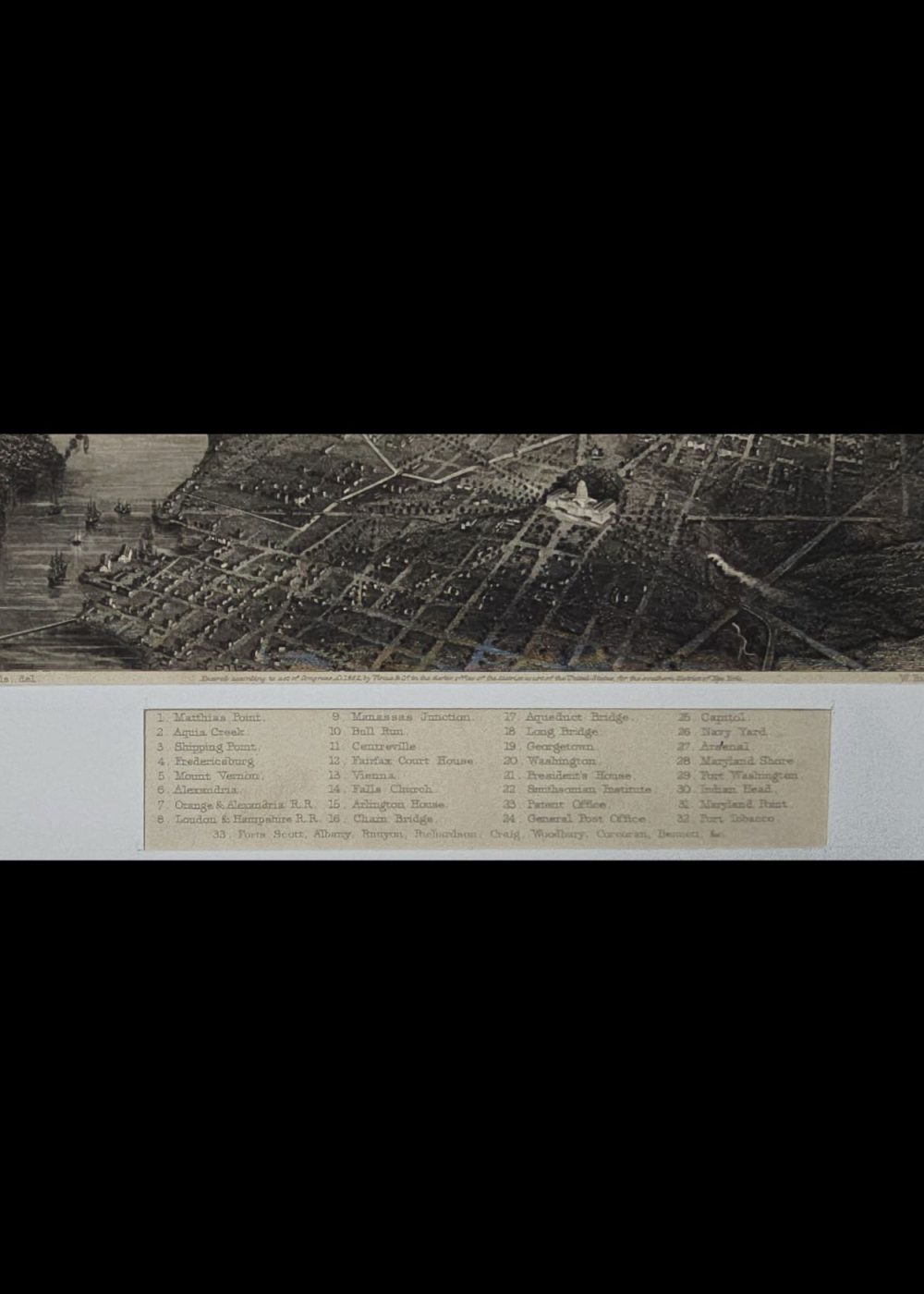
WASHINGTON, D.C. AND ITS VICINITY
Product Details:
Artist or Maker: J. Wells, del
Engraver: W. Ridgway,sc
Engraving Mounting Size (inches): 11.02 (L) x 12 (W) / (cm): 28 (L) x 30.5 (W)
Engraving Image Size (inches): 4.88 (L) x 7.24 (W) / (cm): 12.4 (L) x 18.4 (W)
Please Note:
All prices are inclusive of taxes.
All orders are fully insured during transit for added protection.
This item is not eligible for shipping outside of India.
₹12,999.00
In stock
Description
Returns / Shipping
This is a vintage illustrated map titled “Washington, D.C. and Its Vicinity,” showing a bird’s-eye view of the city and surrounding areas along the Potomac River. The detailed engraving highlights significant landmarks, streets, and natural features, including the U.S. Capitol, the Washington Monument, and Arlington. A numbered index at the bottom identifies key locations such as Fort Washington, Georgetown, and various forts and junctions, reflecting the strategic and civic importance of the region during the 19th century. The map offers a historical perspective of Washington, D.C., emphasizing its layout and proximity to surrounding military and transportation hubs.
Product Details
| Artist or Maker | J. Wells, del |
| Engraver | W. Ridgway,sc |
| Engraving Mounting Size | (inches): 11.02 (L) x 12 (W) / (cm): 28 (L) x 30.5 (W) |
| Engraving Image Size | (inches): 4.88 (L) x 7.24 (W) / (cm): 12.4 (L) x 18.4 (W) |
Returns / Shipping
Returns
We accept returns within 7 days of delivery, provided the item is received in a damaged condition.
Shipping
- Shipping charges are additional and will be calculated based on the delivery address.
- All orders are fully insured during transit for added protection.
- Please note: This item is not eligible for international shipping and can be delivered within India only.