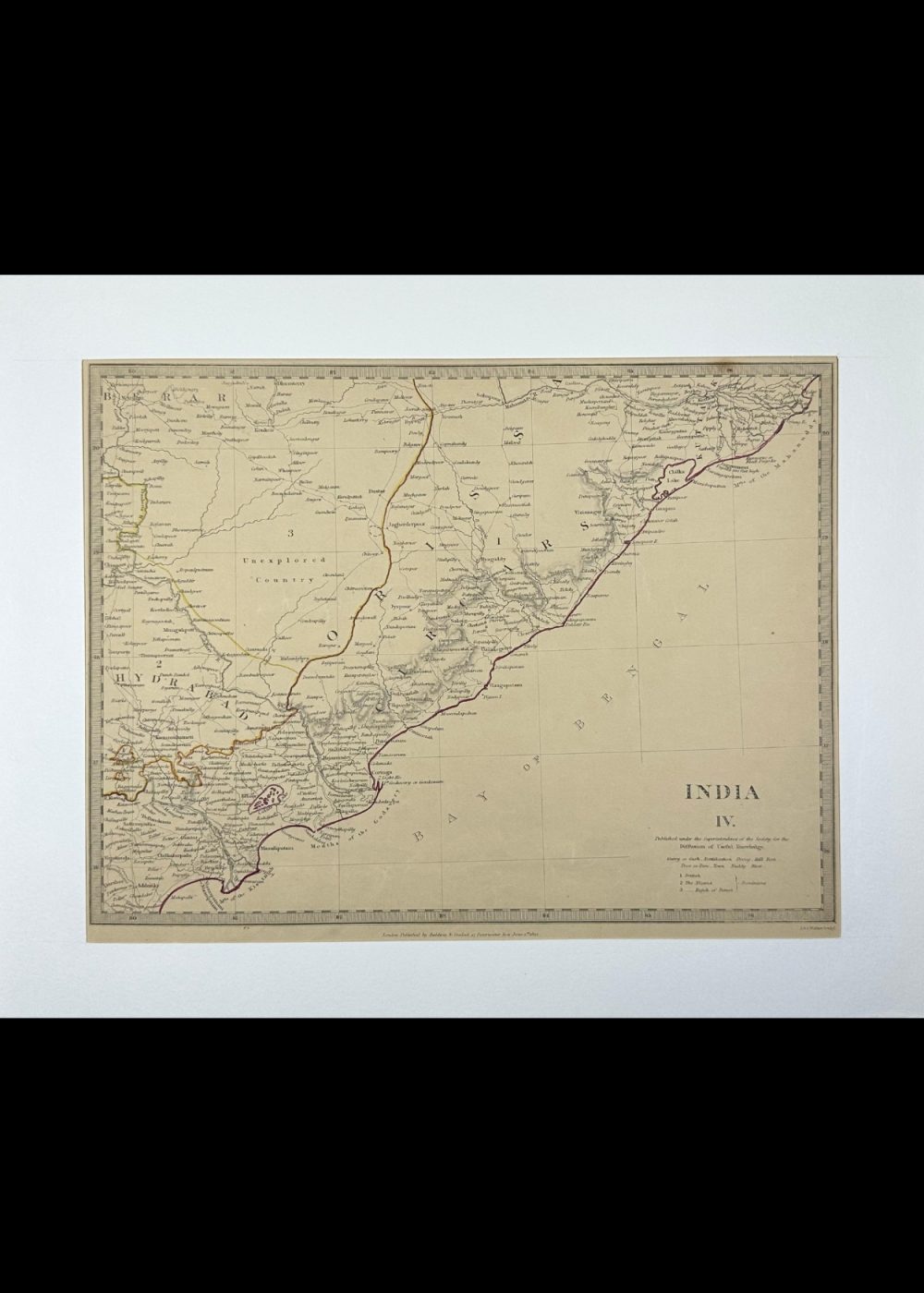
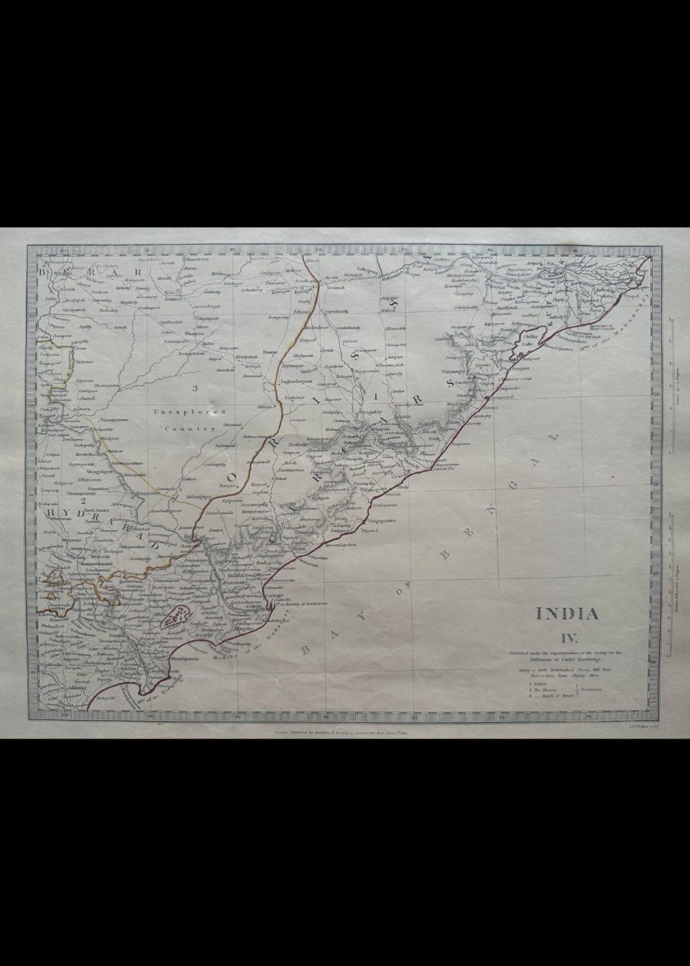
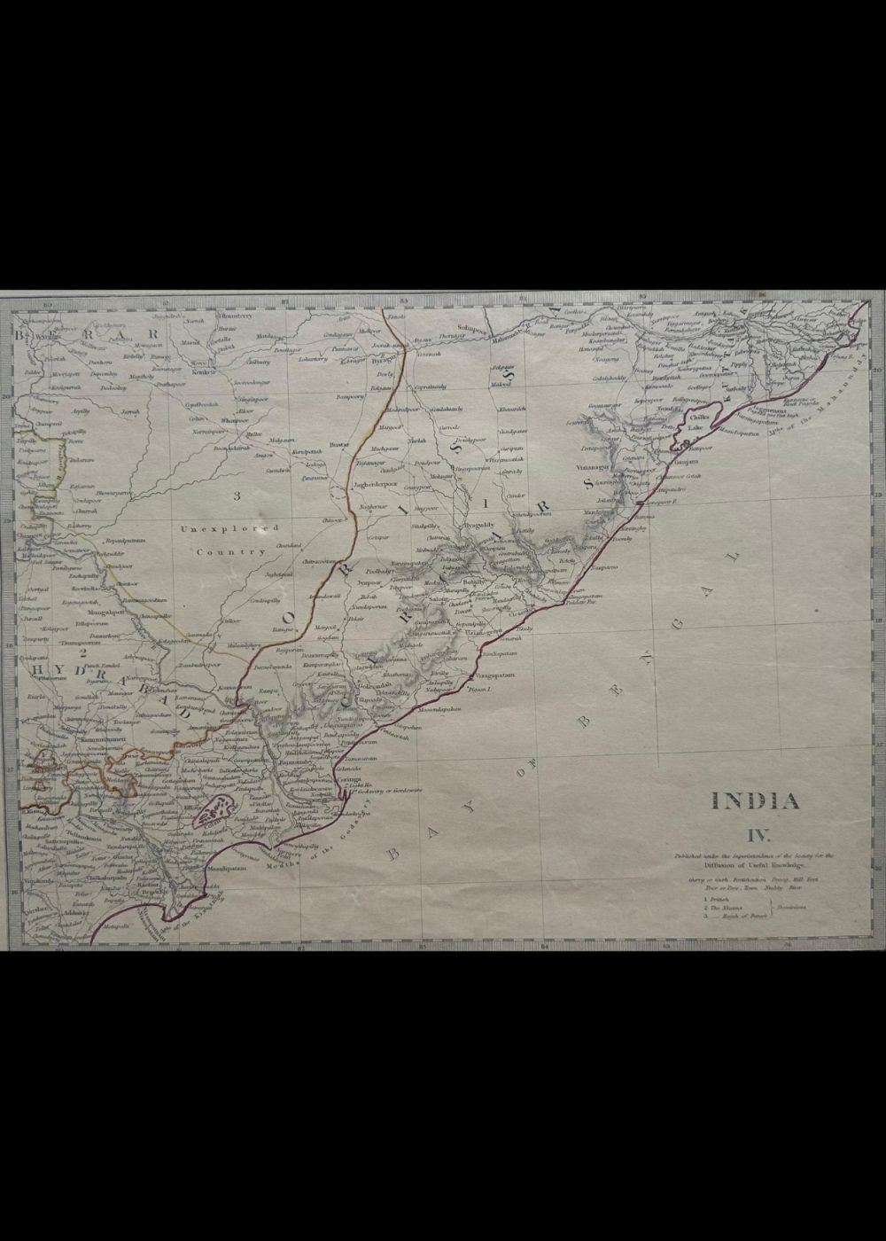
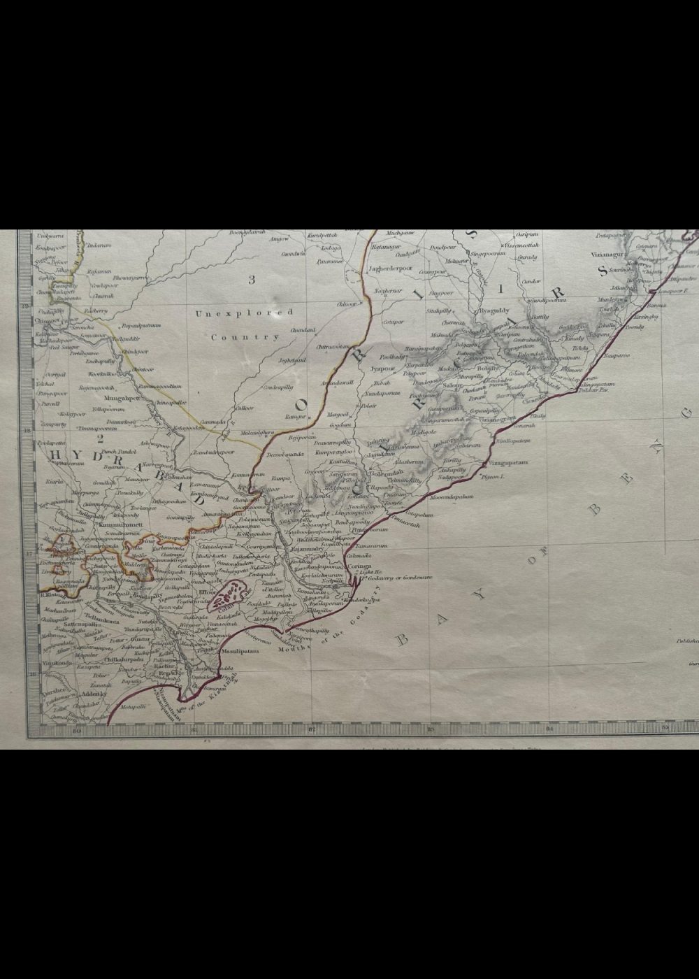
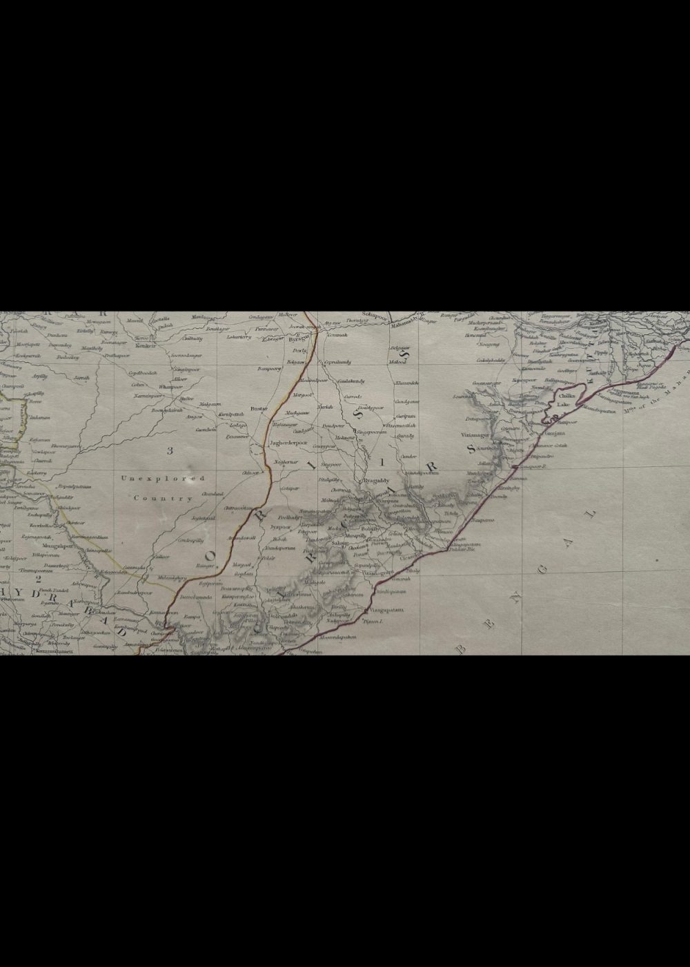
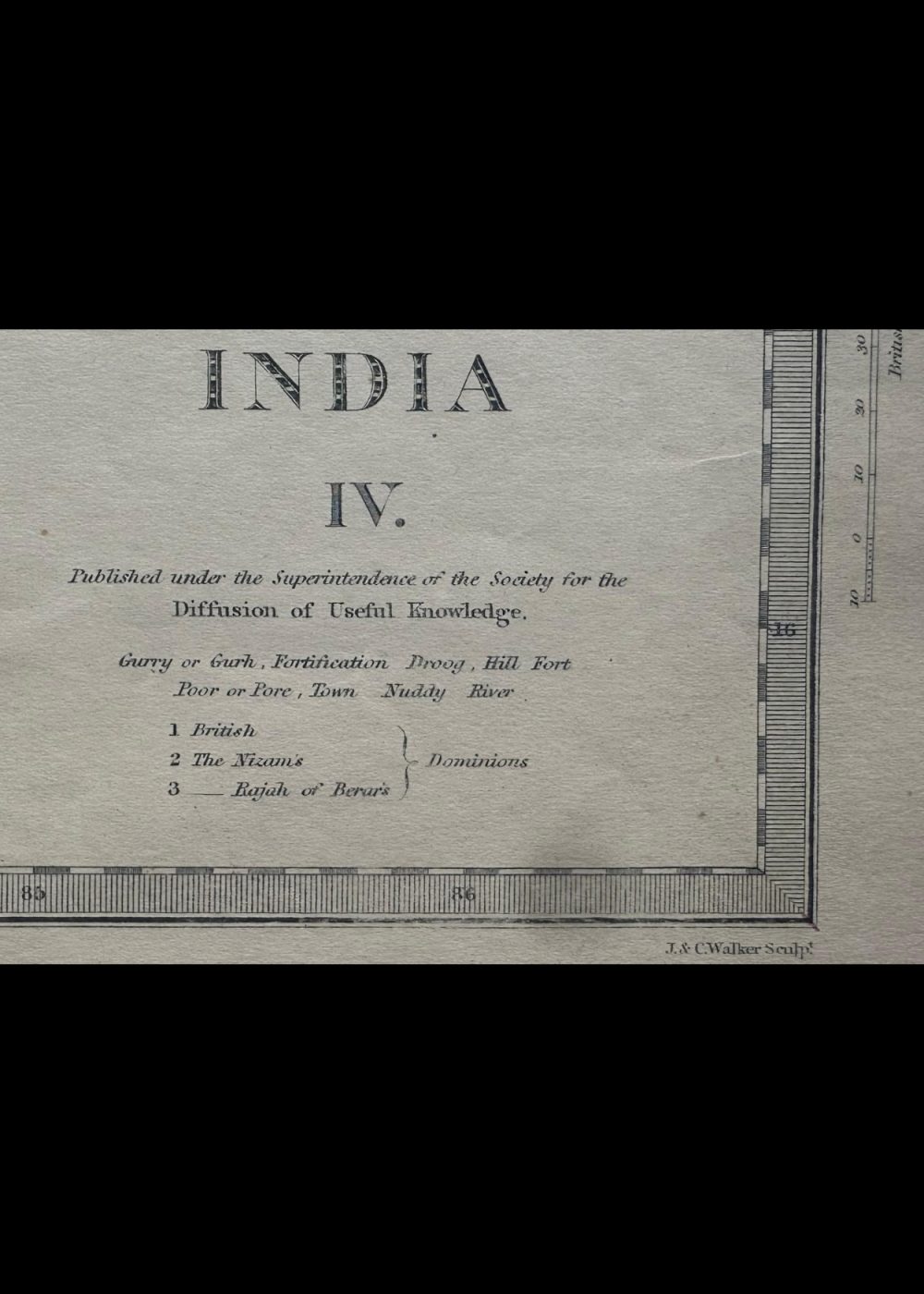
INDIA IV
Product Details:
Artist or Maker: UNKNOWN
Map Mounting Size (inches): 13.98 (L) x 17.4 (W) / (cm): 35.5 (L) x 44.2 (W)
Map Image Size (inches): 10.39 (L) x 13.86 (W) / (cm): 26.4 (L) x 35.2 (W)
Please Note:
All prices are inclusive of taxes.
All orders are fully insured during transit for added protection.
This item is not eligible for shipping outside of India.
₹24,999.00
In stock
Description
Returns / Shipping
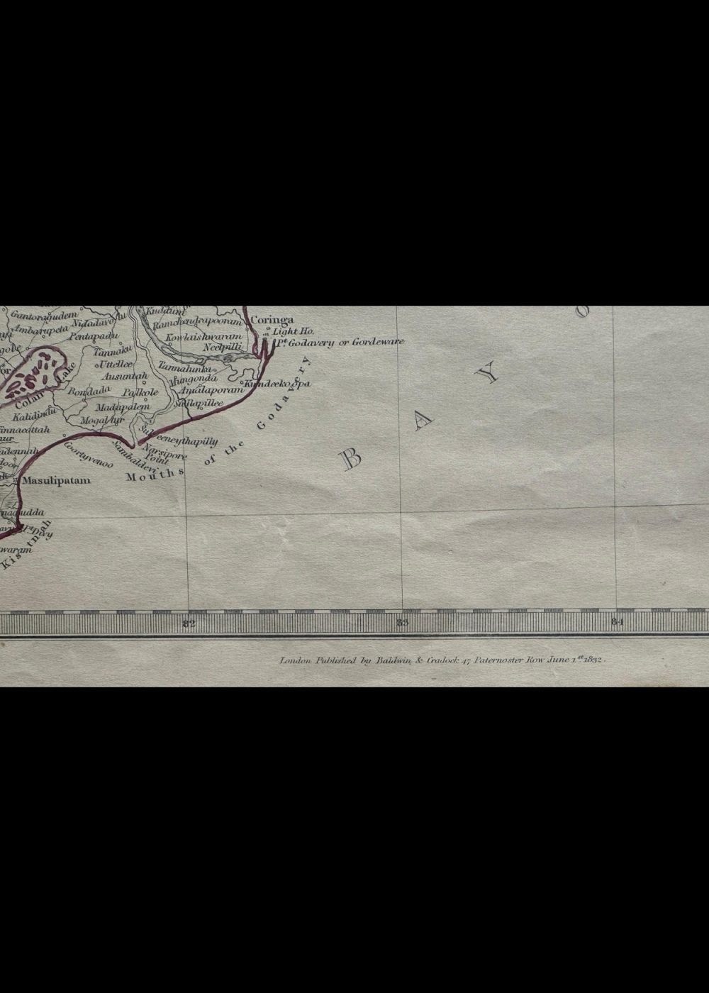
This is a historical map titled “India IV”, created under the Society for the Diffusion of Useful Knowledge. It depicts the eastern regions of India, including Orissa, the Northern Circars, parts of Bengal, and Hyderabad. The map features detailed markings of towns, rivers, and terrain, with some areas labeled as “Unexplored Country.” Bordered by the Bay of Bengal, it offers a fascinating glimpse into the colonial-era geography and administrative divisions of eastern India.
Product Details
| Artist or Maker | UNKNOWN |
| Map Mounting Size | (inches): 13.98 (L) x 17.4 (W) / (cm): 35.5 (L) x 44.2 (W) |
| Map Image Size | (inches): 10.39 (L) x 13.86 (W) / (cm): 26.4 (L) x 35.2 (W) |
Returns / Shipping
Returns
We accept returns within 7 days of delivery, provided the item is received in a damaged condition.
Shipping
- Shipping charges are additional and will be calculated based on the delivery address.
- All orders are fully insured during transit for added protection.
- Please note: This item is not eligible for international shipping and can be delivered within India only.