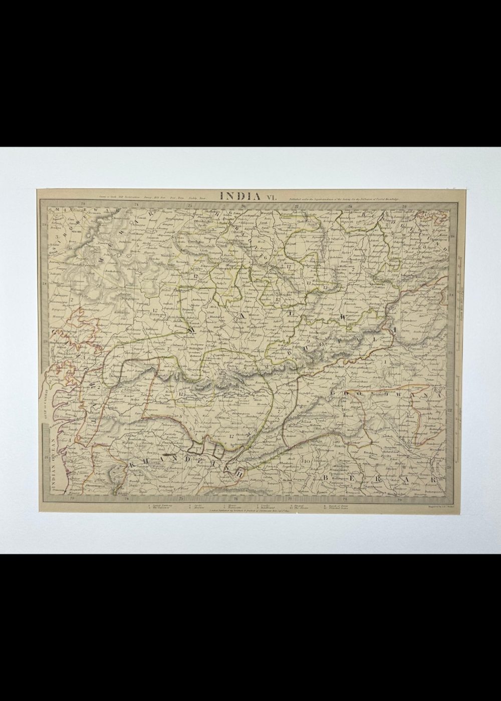
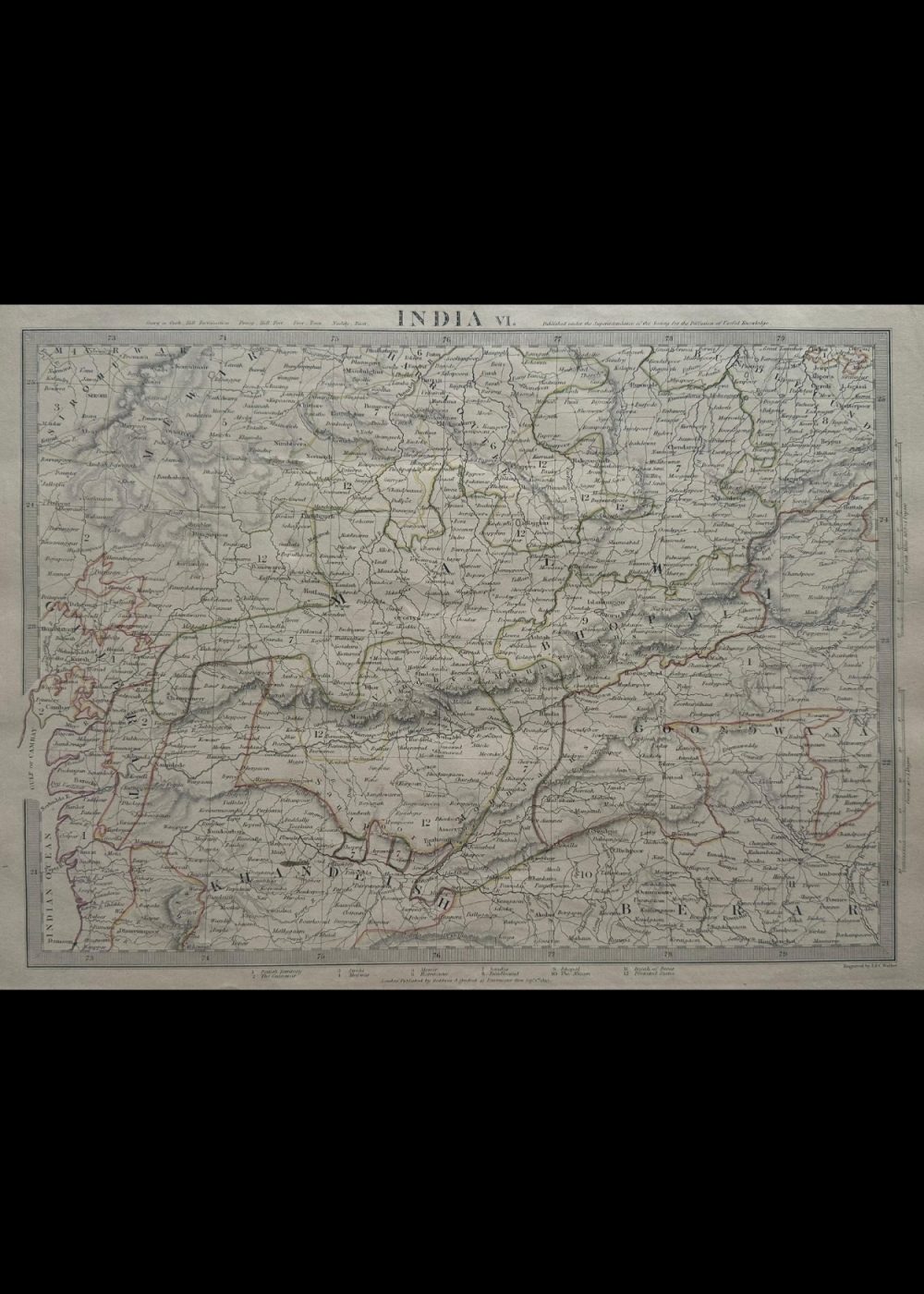
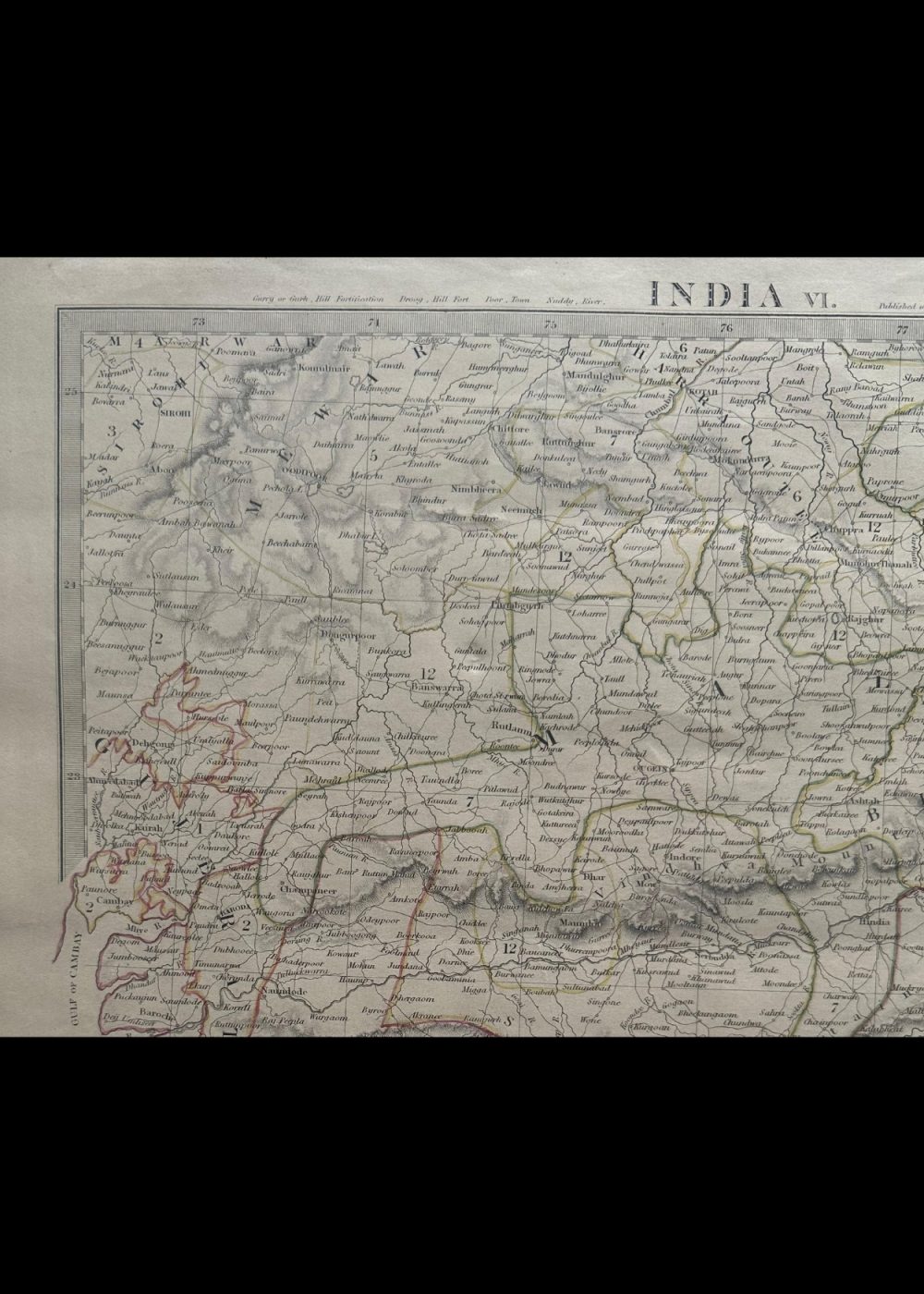
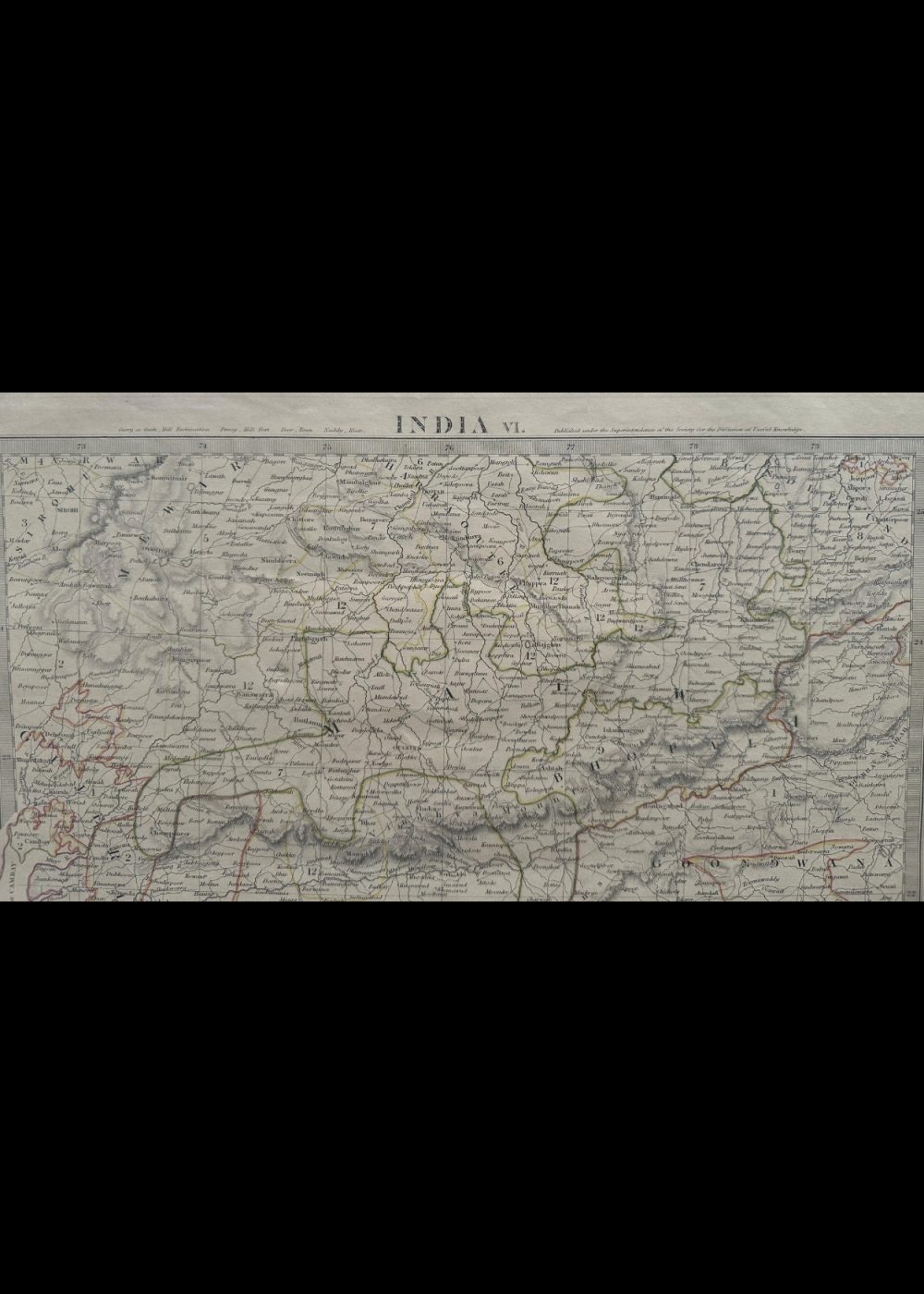

INDIA VI
Product Details:
Artist or Maker: UNKNOWN
Map Mounting Size (inches): 13.98 (L) x 17.32 (W) / (cm): 35.5 (L) x 44 (W)
Map Image Size (inches): 10.31 (L) x 13.86 (W) / (cm): 26.2 (L) x 35.2 (W)
Please Note:
All prices are inclusive of taxes.
All orders are fully insured during transit for added protection.
This item is not eligible for shipping outside of India.
₹24,999.00
In stock
Description
Returns / Shipping
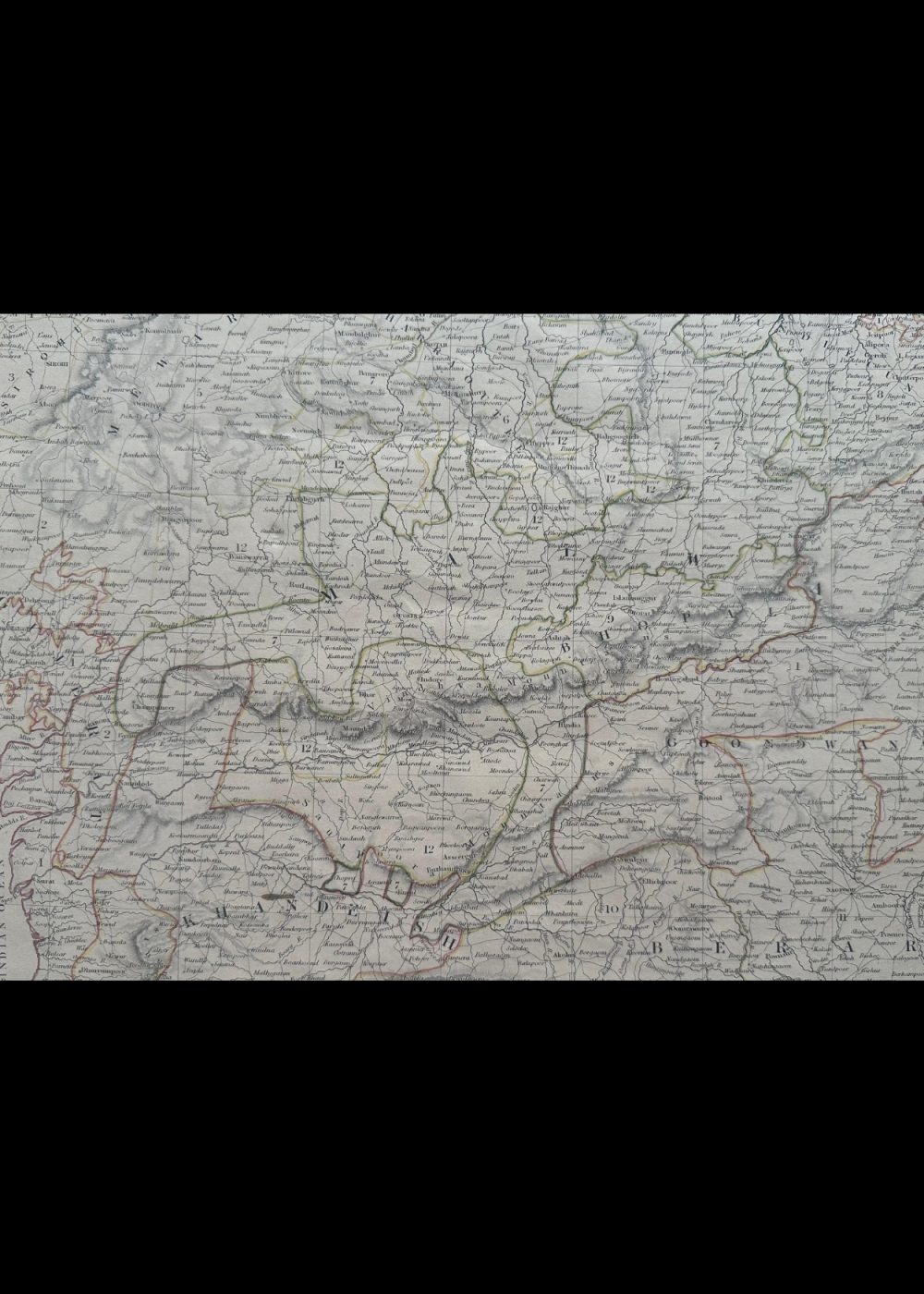
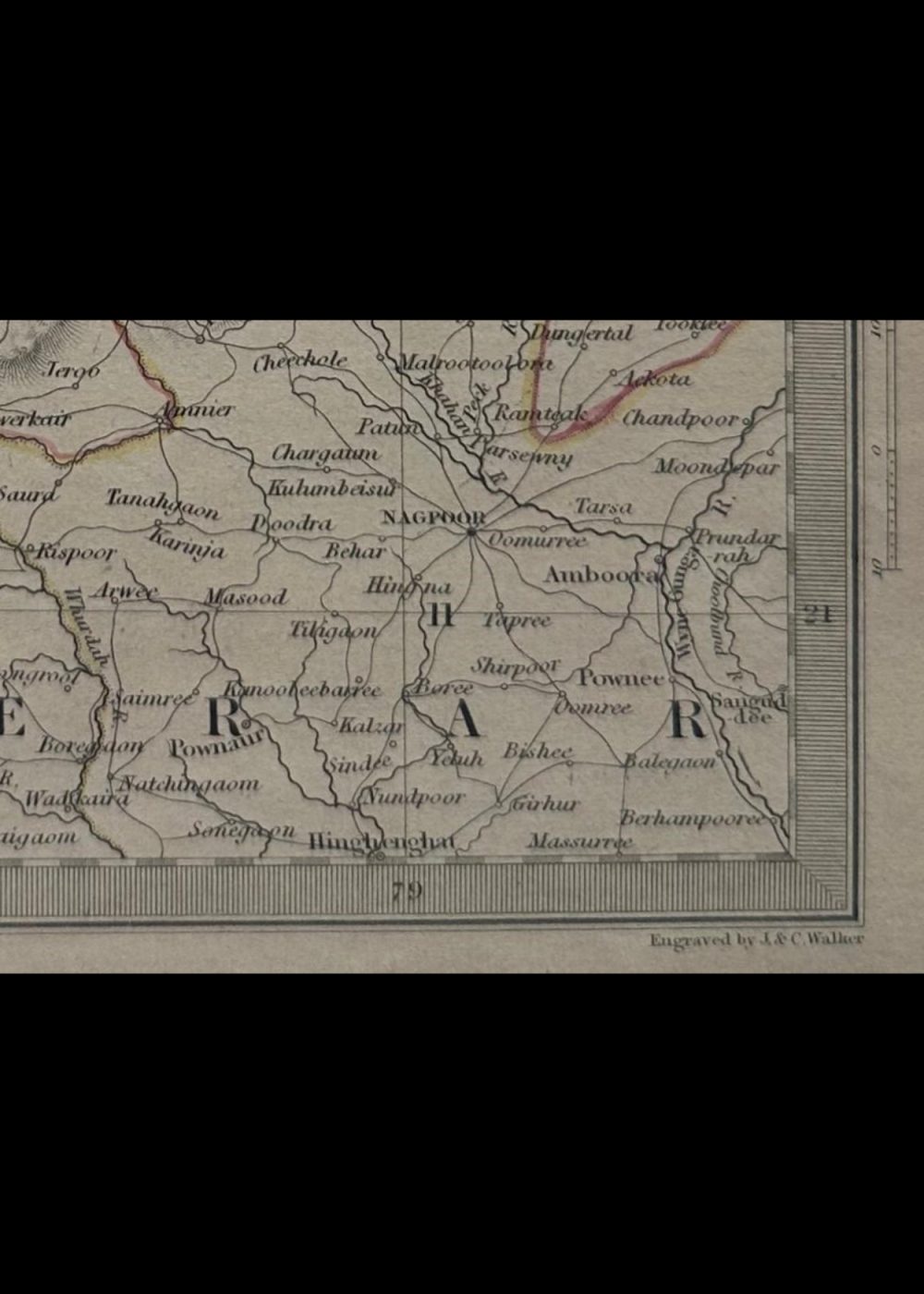
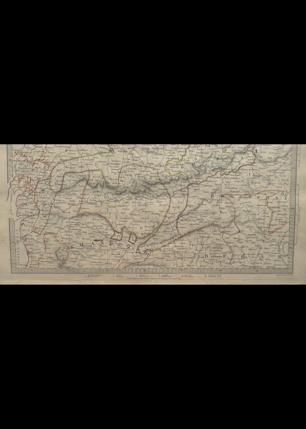
This is a vintage cartographic map titled “INDIA VI”, produced under the direction of the Society for the Diffusion of Useful Knowledge. The map meticulously illustrates various regions of the Indian subcontinent with distinct color-coded boundaries, highlighting towns, rivers, and geographic features. Numbered and labeled locations provide a glimpse into colonial-era administrative divisions. As both a historical artifact and a geographic reference, it showcases the complexity and diversity of India during the early 19th century.
Product Details
| Artist or Maker | UNKNOWN |
| Map Mounting Size | (inches): 13.98 (L) x 17.32 (W) / (cm): 35.5 (L) x 44 (W) |
| Map Image Size | (inches): 10.31 (L) x 13.86 (W) / (cm): 26.2 (L) x 35.2 (W) |
Returns / Shipping
Returns
We accept returns within 7 days of delivery, provided the item is received in a damaged condition.
Shipping
- Shipping charges are additional and will be calculated based on the delivery address.
- All orders are fully insured during transit for added protection.
- Please note: This item is not eligible for international shipping and can be delivered within India only.