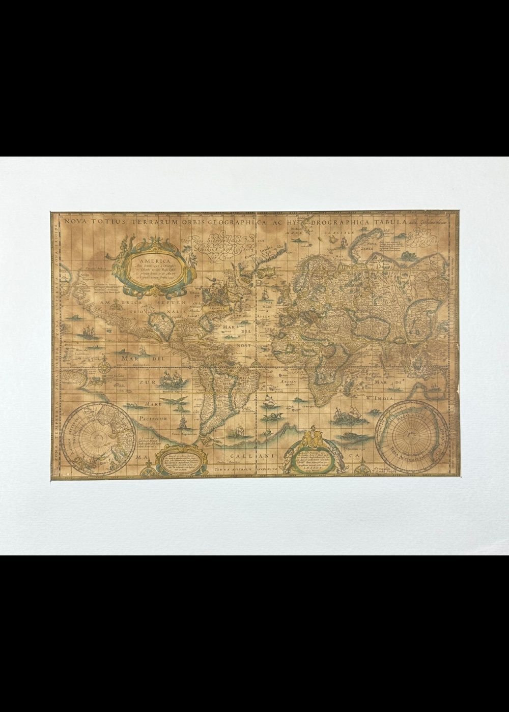
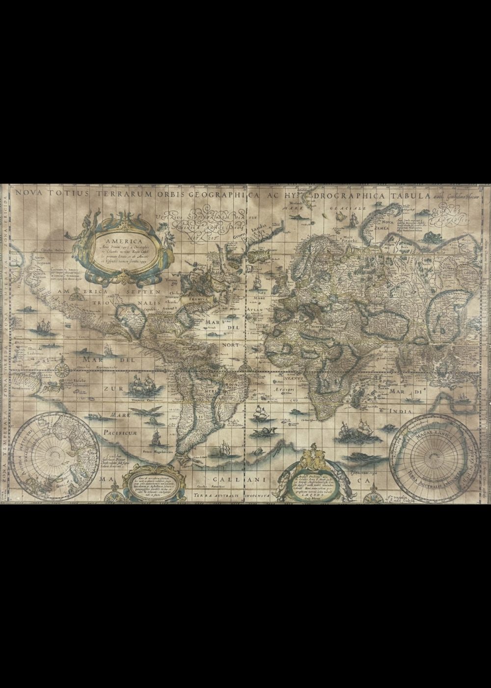
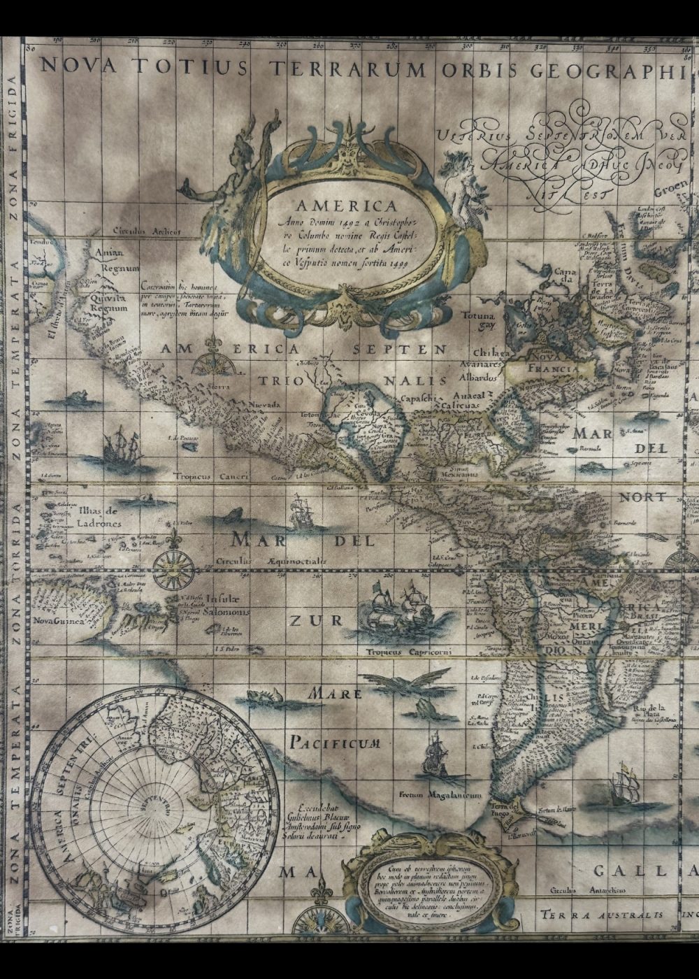
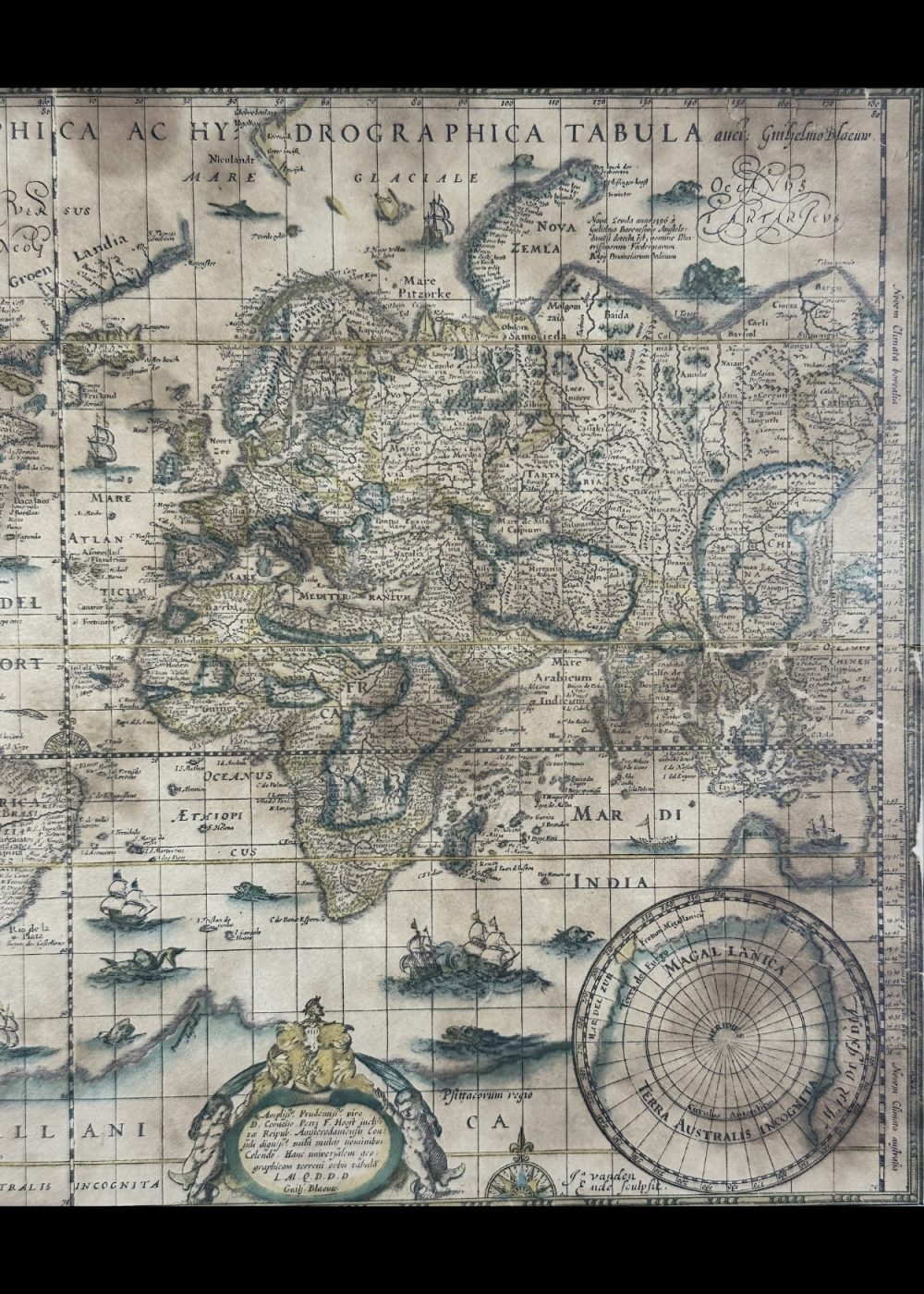
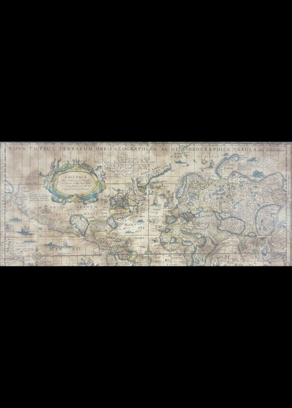
WORLD MAP
Product Details:
Artist or Maker: UNKNOWN
Map Mounting Size (inches): 11.1 (L) x 14.06 (W) / (cm): 28.2 (L) x 35.7 (W)
Map Image Size (inches): 7.72 (L) x 11.22 (W) / (cm): 19.6 (L) x 28.5 (W)
Please Note:
All prices are inclusive of taxes.
All orders are fully insured during transit for added protection.
This item is not eligible for shipping outside of India.
₹24,999.00
In stock
Description
Returns / Shipping
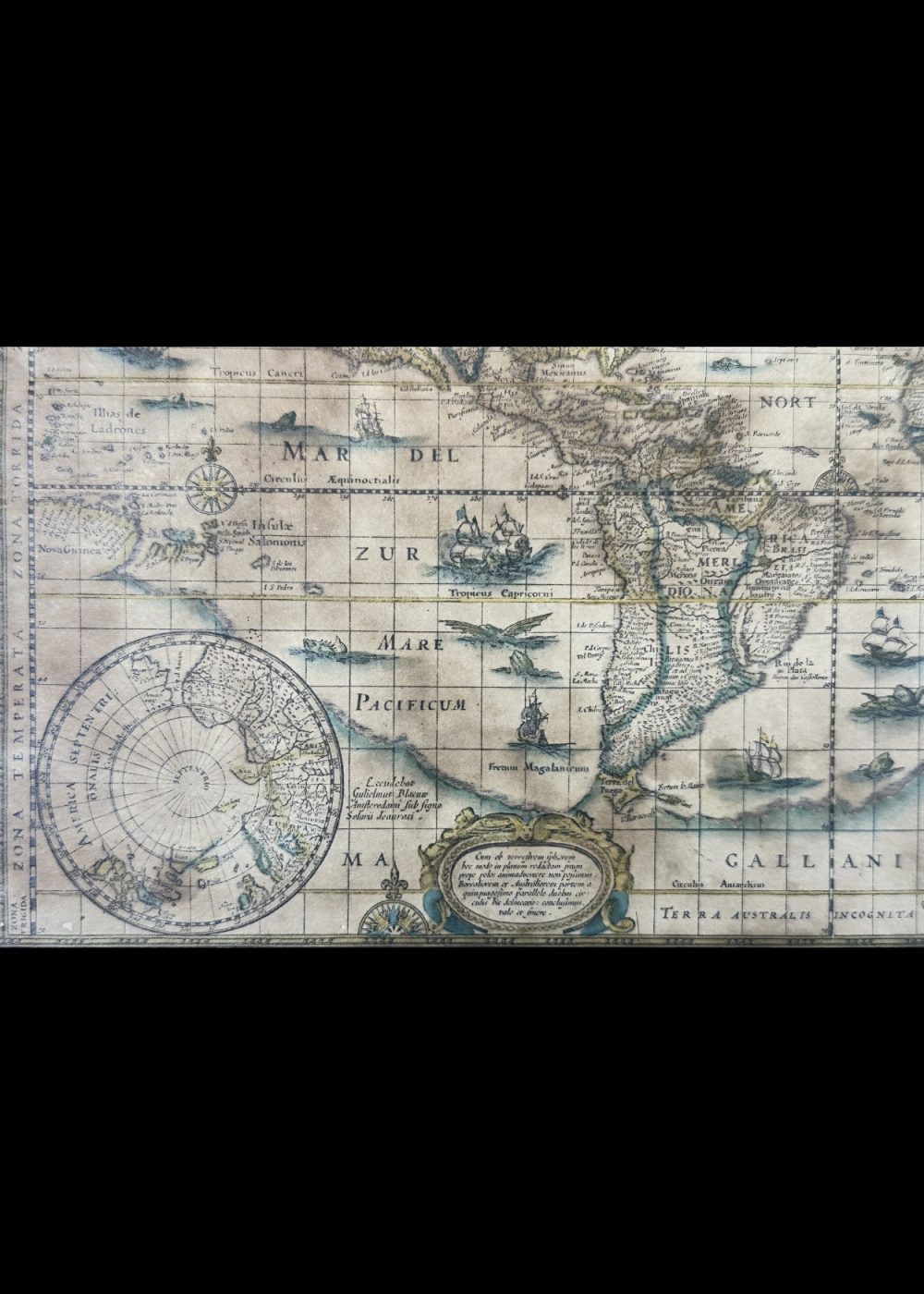
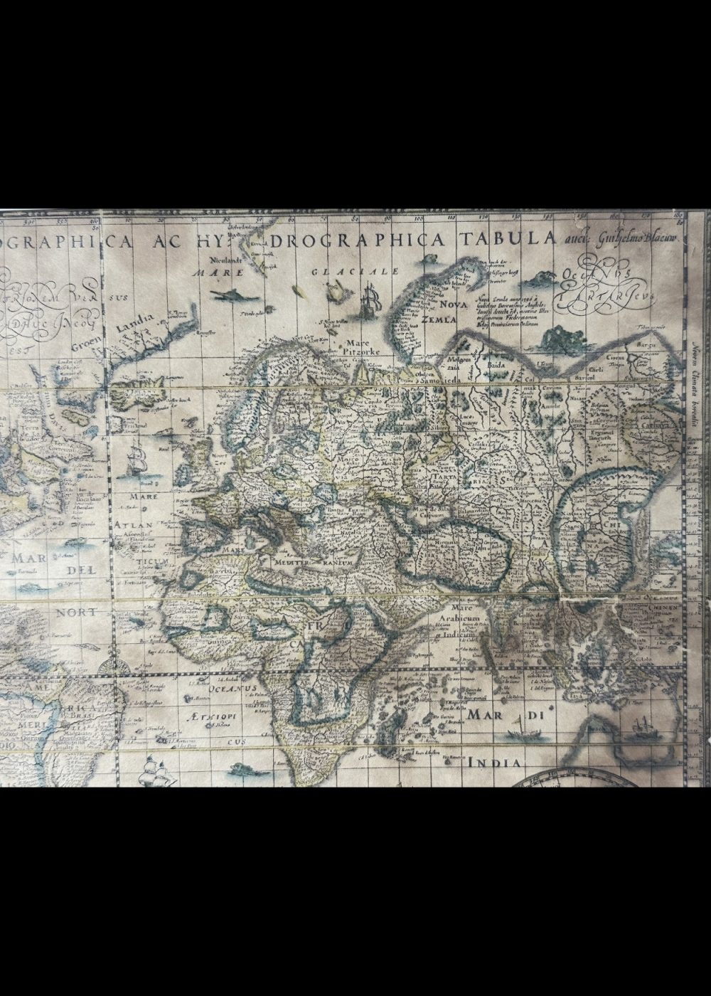
This beautifully illustrated early 17th-century world map, titled “Nova Totius Terrarum Orbis Geographica Ac Hydrographica Tabula”, showcases the known world as it was understood during the Age of Exploration. Created by Willem Blaeu, a renowned Dutch cartographer, it combines geographic detail with decorative artistry, including sea monsters, sailing ships, and compass roses. The map features the continents of Europe, Asia, Africa, and the Americas with speculative coastlines, and includes polar insets. A masterpiece of historical cartography, this piece is both a scientific document and a work of art.
Product Details
| Artist or Maker | UNKNOWN |
| Map Mounting Size | (inches): 11.1 (L) x 14.06 (W) / (cm): 28.2 (L) x 35.7 (W) |
| Map Image Size | (inches): 7.72 (L) x 11.22 (W) / (cm): 19.6 (L) x 28.5 (W) |
Returns / Shipping
Returns
We accept returns within 7 days of delivery, provided the item is received in a damaged condition.
Shipping
- Shipping charges are additional and will be calculated based on the delivery address.
- All orders are fully insured during transit for added protection.
- Please note: This item is not eligible for international shipping and can be delivered within India only.