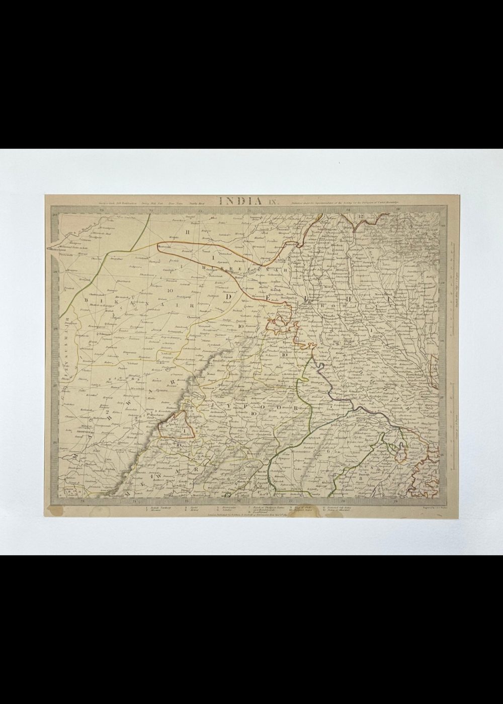
INDIA IX
Product Details:
Artist or Maker: UNKNOWN
Map Mounting Size (inches): 13.98 (L) x 17.4 (W) / (cm): 35.5 (L) x 44.2 (W)
Map Image Size (inches): 13.54 (L) x 10.24 (W) / (cm): 34.4 (L) x 26 (W)
Please Note:
All prices are inclusive of taxes.
All orders are fully insured during transit for added protection.
This item is not eligible for shipping outside of India.
In stock
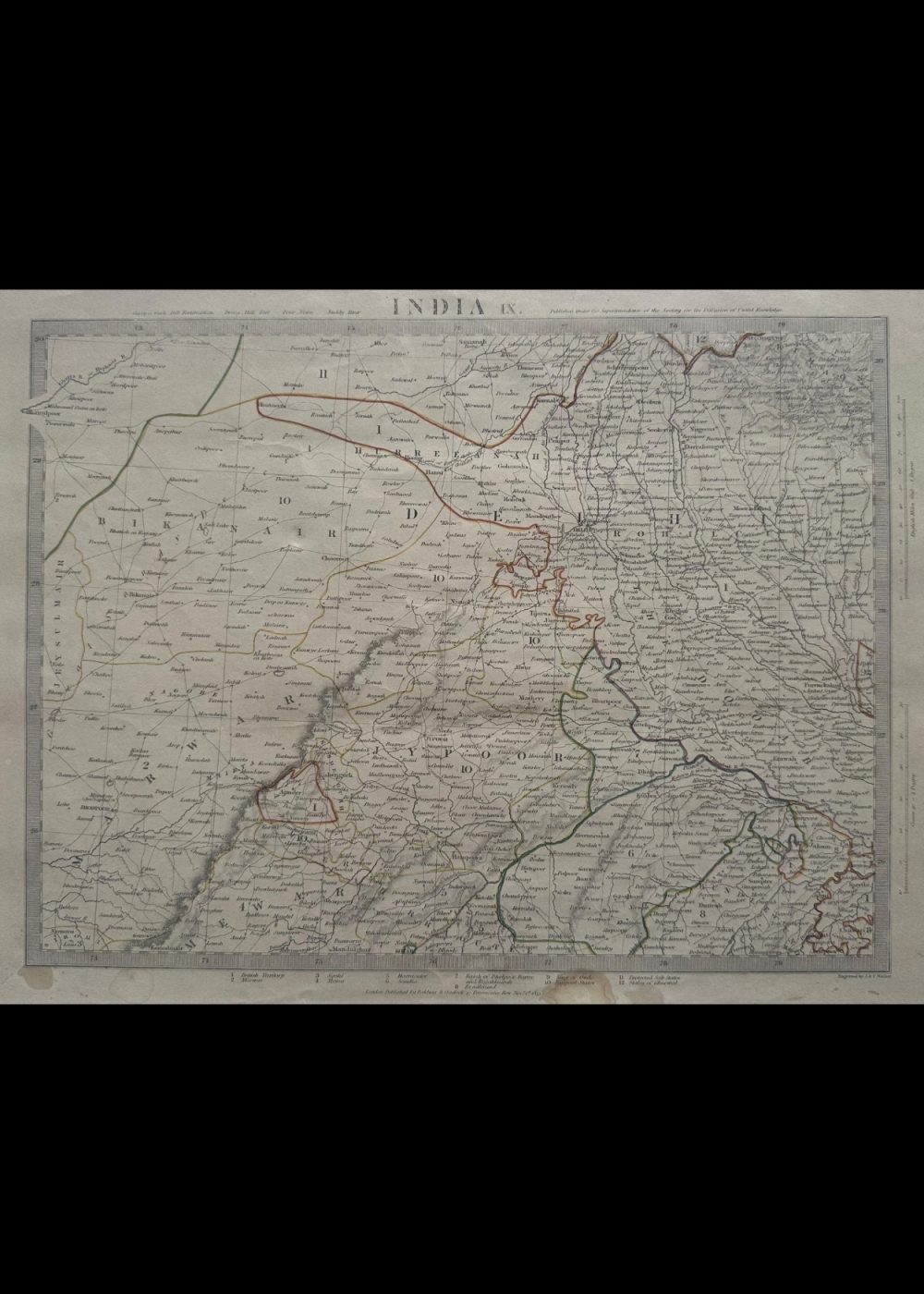
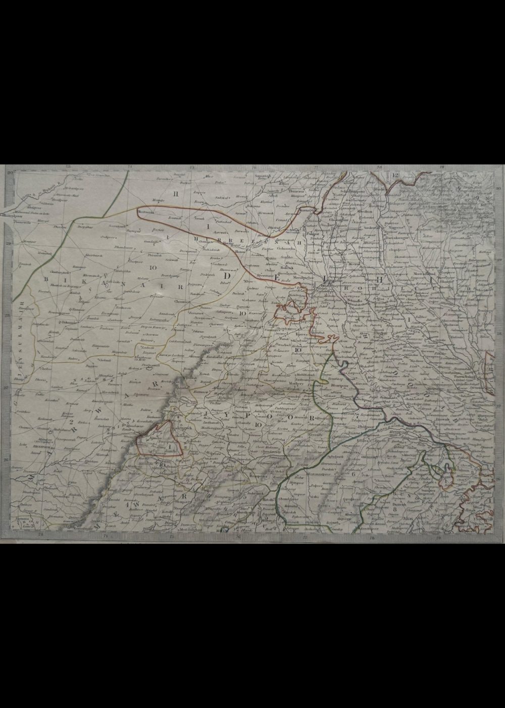
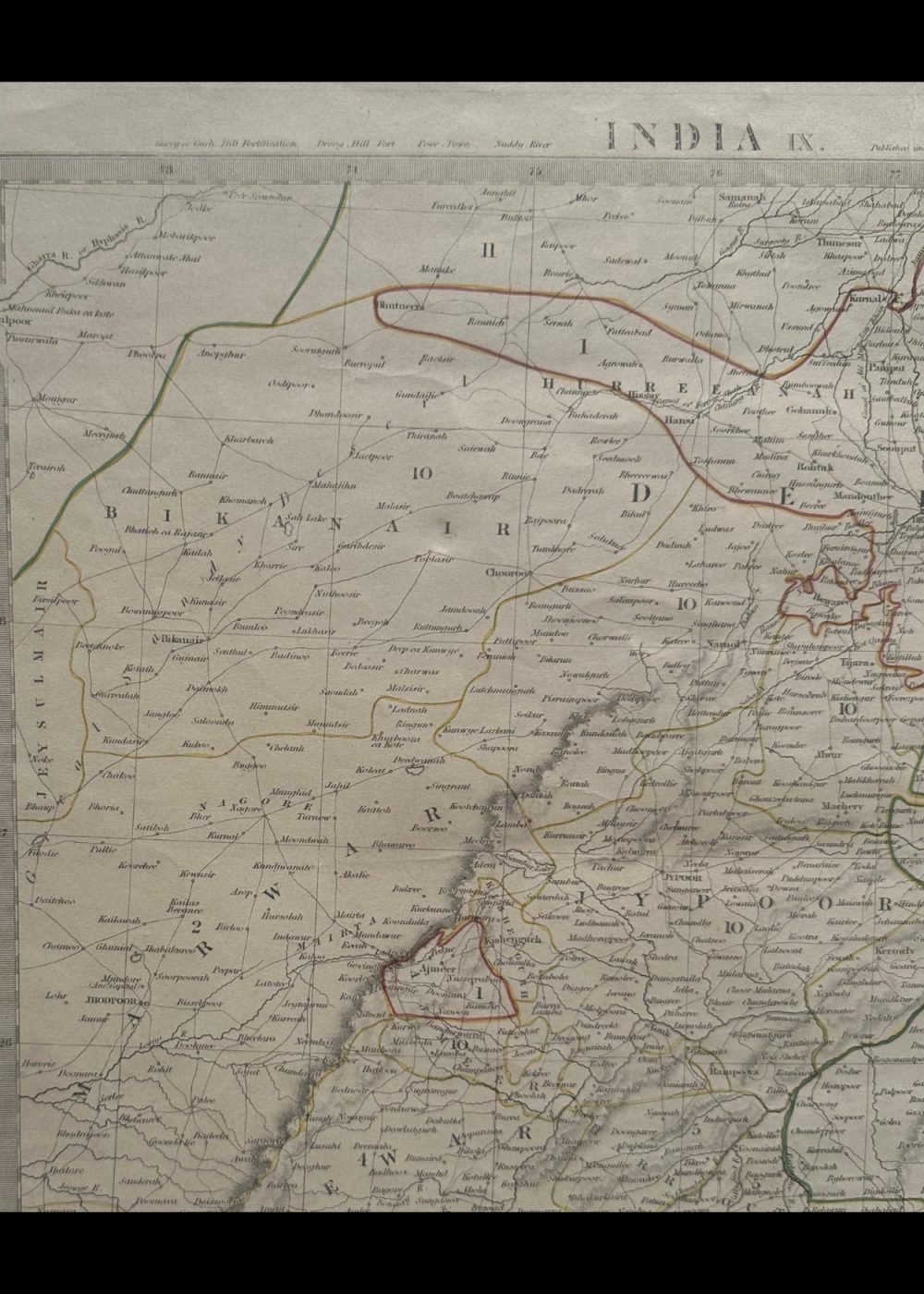
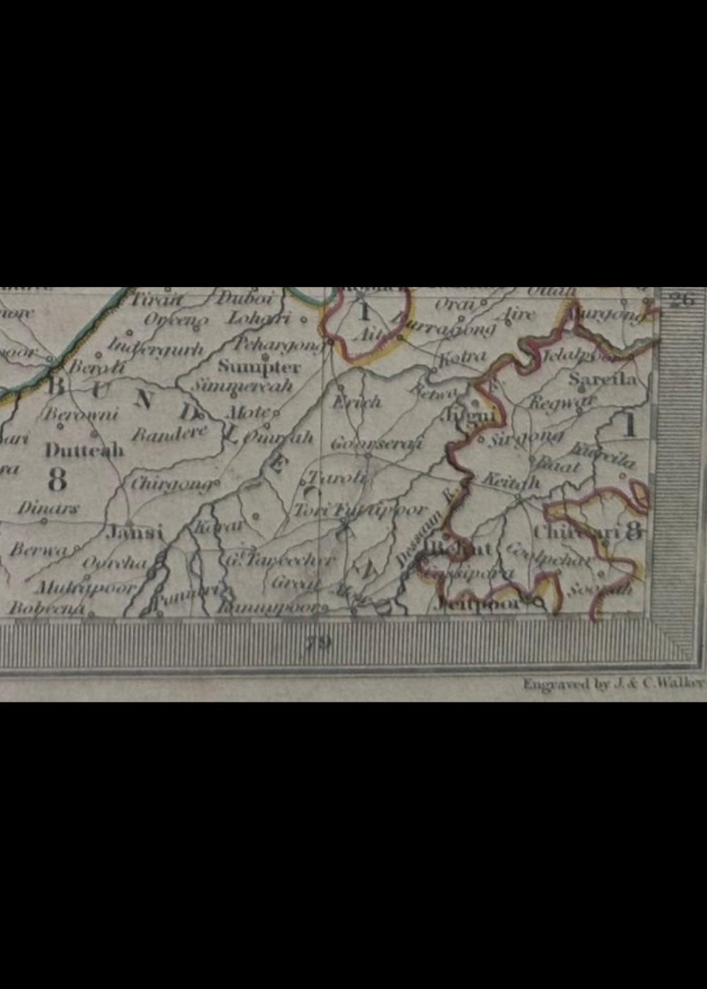
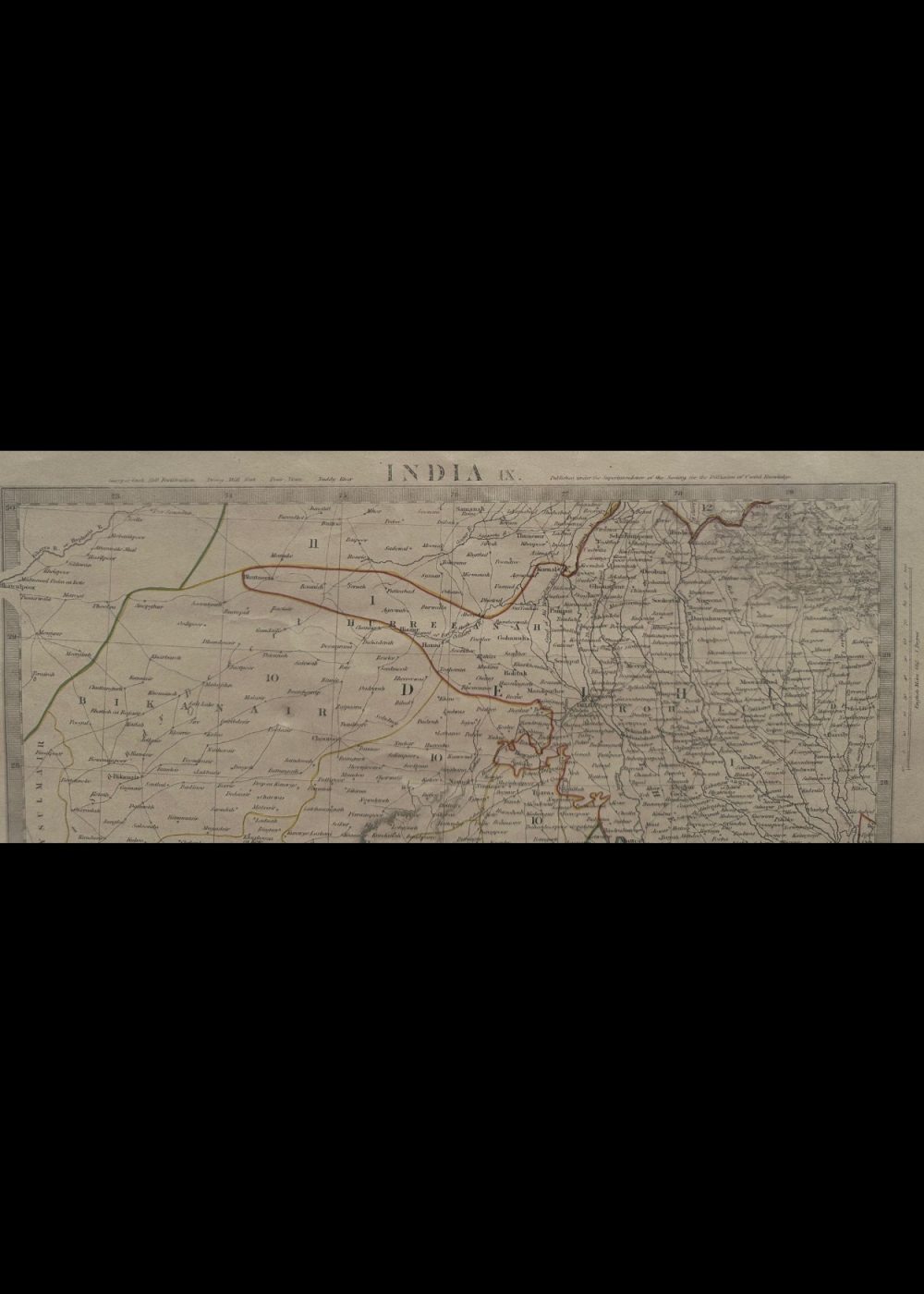
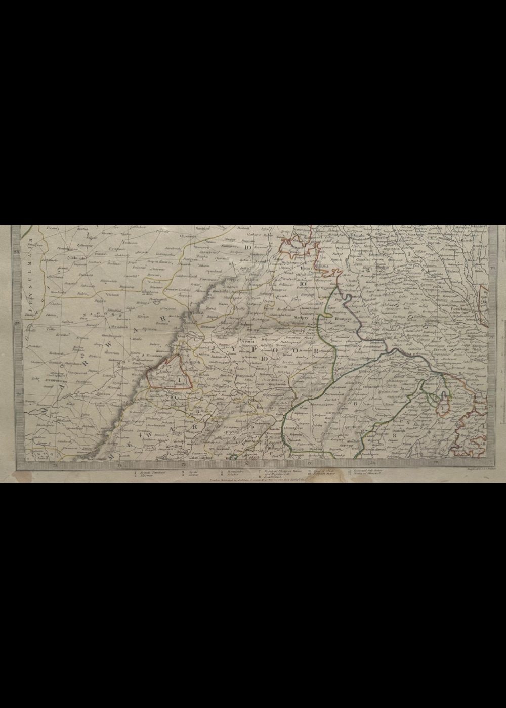
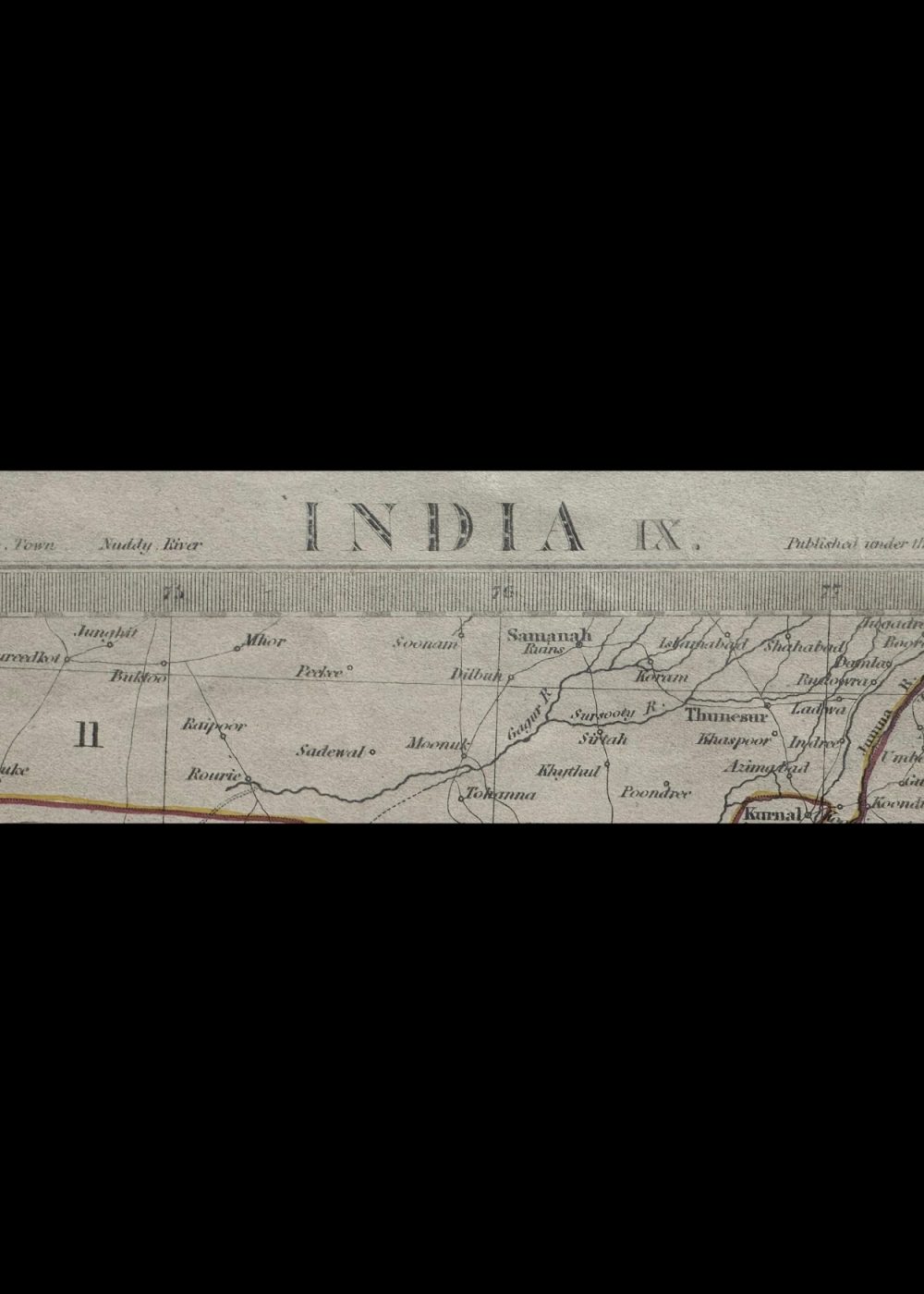
This is a historical map titled “India IX,” printed by Baldwin & Cradock on June 15, 1835, under the supervision of the Society for the Diffusion of Useful Knowledge. The map displays a detailed view of various regions of the Indian subcontinent during the British colonial era, each section outlined and labeled with Roman numerals like I–XII, R, and D. It features geographical elements such as rivers, mountain ranges, and place names, reflecting the administrative and political divisions of early 19th-century India. The color-coded regions provide insight into territorial organization at the time.
Product Details
| Artist or Maker | UNKNOWN |
| Map Mounting Size | (inches): 13.98 (L) x 17.4 (W) / (cm): 35.5 (L) x 44.2 (W) |
| Map Image Size | (inches): 13.54 (L) x 10.24 (W) / (cm): 34.4 (L) x 26 (W) |
Returns / Shipping
Returns
We accept returns within 7 days of delivery, provided the item is received in a damaged condition.
Shipping
- Shipping charges are additional and will be calculated based on the delivery address.
- All orders are fully insured during transit for added protection.
- Please note: This item is not eligible for international shipping and can be delivered within India only.