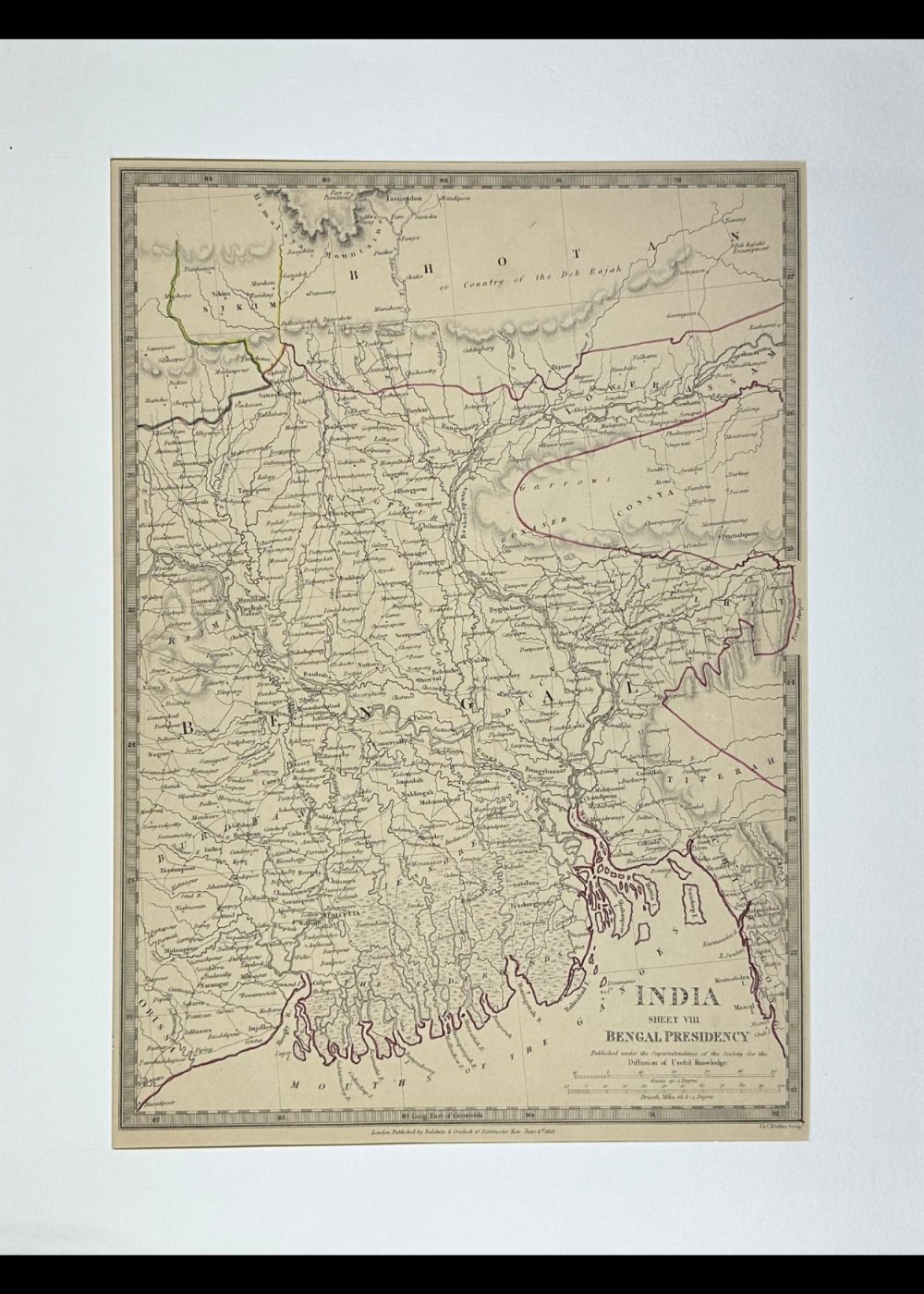
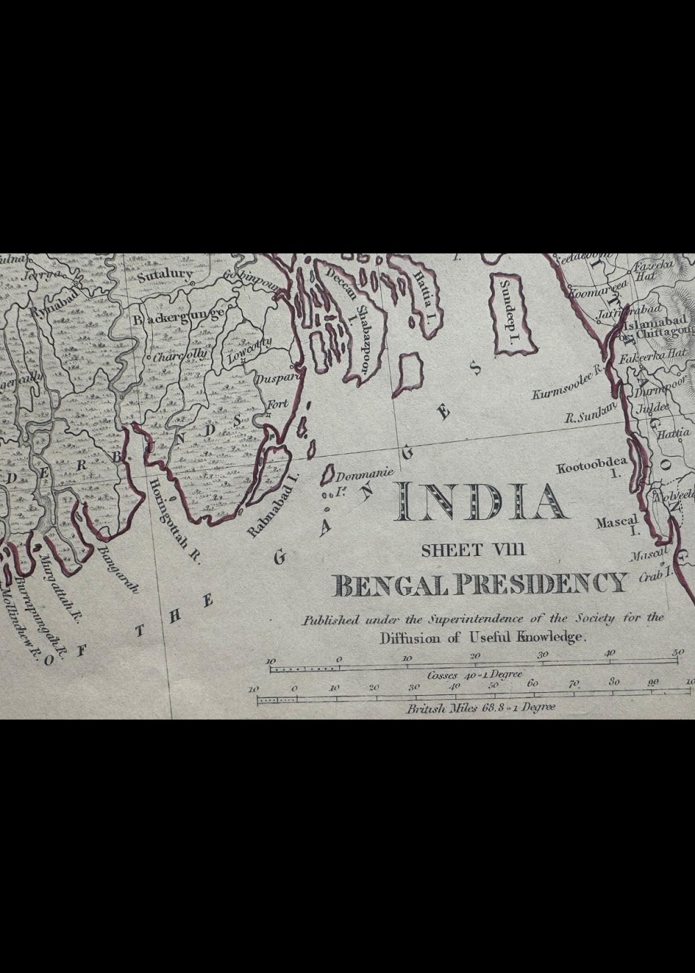
INDIA VIII BENGAL PRESIDENCY
Product Details:
Artist or Maker: UNKNOWN
Map Mounting Size (inches): 18.31 (L) x 13.98 (W) / (cm): 46.5 (L) x 35.5 (W)
Map Image Size (inches): 10.04 (L) x 14.09 (W) / (cm): 25.5 (L) x 35.8 (W)
Please Note:
All prices are inclusive of taxes.
All orders are fully insured during transit for added protection.
This item is not eligible for shipping outside of India.
₹24,999.00
In stock
Description
Returns / Shipping
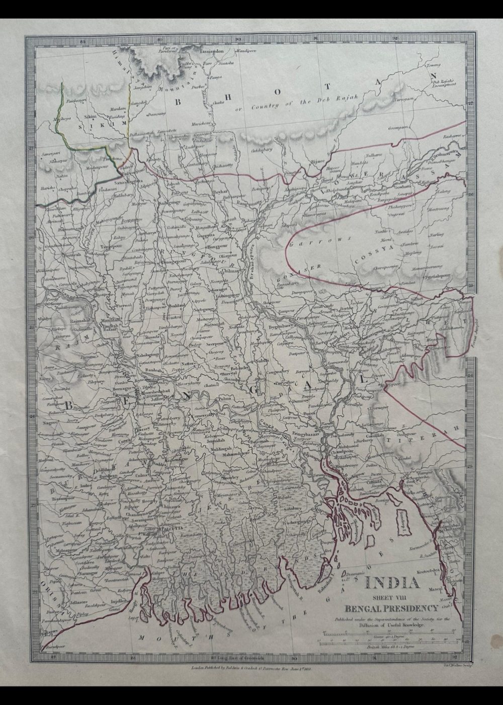
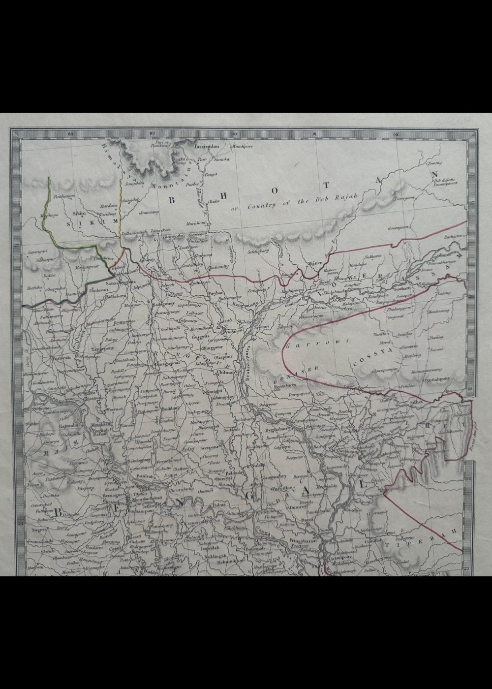
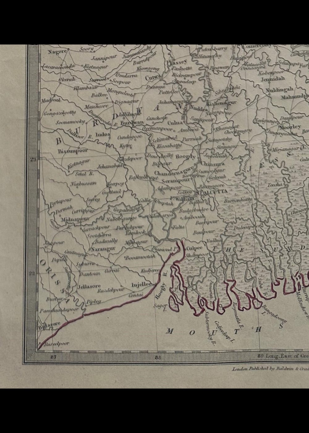
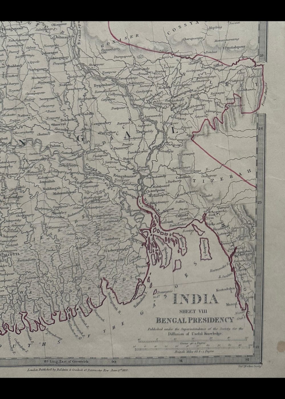
This is a historical map titled “India VIII — Bengal Presidency,” published by Baldwin & Cradock on June 1, 1831, under the direction of the Society for the Diffusion of Useful Knowledge. It portrays the Bengal Presidency during British colonial rule, capturing detailed administrative boundaries, rivers, towns, and major cities of that time. The map also includes parts of modern-day Bangladesh, Nepal, and Bhutan, offering a rich visual record of the political and geographic layout of Eastern India in the early 19th century.
Product Details
| Artist or Maker | UNKNOWN |
| Map Mounting Size | (inches): 18.31 (L) x 13.98 (W) / (cm): 46.5 (L) x 35.5 (W) |
| Map Image Size | (inches): 10.04 (L) x 14.09 (W) / (cm): 25.5 (L) x 35.8 (W) |
Returns / Shipping
Returns
We accept returns within 7 days of delivery, provided the item is received in a damaged condition.
Shipping
- Shipping charges are additional and will be calculated based on the delivery address.
- All orders are fully insured during transit for added protection.
- Please note: This item is not eligible for international shipping and can be delivered within India only.